Rhode Island
Date:
1741
Reference:
MR 1/27
Creator:
Maps and plans extracted to rolled storage from records of various departments
Catalogue context:
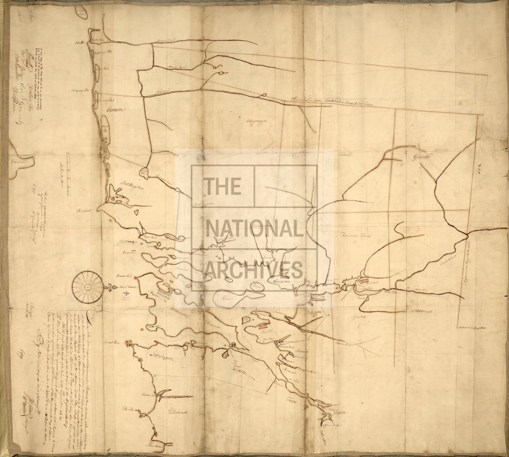
1 item extracted from CO 5/1303 . North America: Rhode Island (now in the United States of America). 'An Exact Plan of the Sea Coast of the Continent from Paucatuck [ sic , Pawcatuck] River Eastwards to Point Judith and from thence Northwards to the Town of Providence and from thence Southerly or (sic) the Easterly Shore round Bristol and from thence North Easterly to Assonet [in Massachusetts] and from thence Southerly to Seaconel Point and from thence Easterly to Slocums Harbour ...': map showing towns, ponds, islands rivers, and the boundaries with Connecticut and Massachusetts. Scale: 1 inch to 1.25 miles. Compass rose. Surveyed by James Helme and William Chandler, 24 June 1741; certified as a true copy by His Majesty's Court of Commissioners, 8 September 1741.
Categories:
Maps and plans
Subjects:
Americas; Archives and libraries; Maps and plans
Topics:
International trade and affairs; Land and buildings
Period:
Early Modern
Copyright information:
Copyright clearance for publication is not required, except in the case of documents in third-party copyright.
Usage terms:
https://www.nationalarchives.gov.uk/documents/information-management/use-of-tna-materials.pdf