Charlottetown, Prince Edward Island, Canada
Date:
1768
Reference:
MR 1/31
Creator:
Maps and plans extracted to rolled storage from records of various departments
Catalogue context:
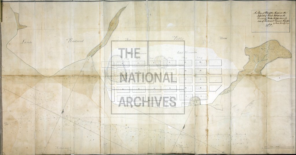
1 item (enclosure to despatch number 16, 31 July 1768) extracted from CO 217/45 (folio 249). North America. 'A Plan of Charlotte Town on the Island of St. John [now Charlottetown, Prince Edward Island, Canada] ... drawn by Order of Lieutenant Governor Francklin by Charles Morris Chf Surveyor 1768': showing the eastern and western divisions of the town laid out in lots, land reserved for public lots and buildings and for proprietors, marshland and swamps, and soundings. Scale: 1 inch to 200 feet. Compass indicator.
Categories:
Maps and plans; Overseas
Subjects:
Americas; Archives and libraries; Maps and plans
Topics:
International trade and affairs; Land and buildings
Period:
Empire And Industry
Places:
Canada
Copyright information:
Copyright clearance for publication is not required, except in the case of documents in third-party copyright.
Usage terms:
https://www.nationalarchives.gov.uk/documents/information-management/use-of-tna-materials.pdf