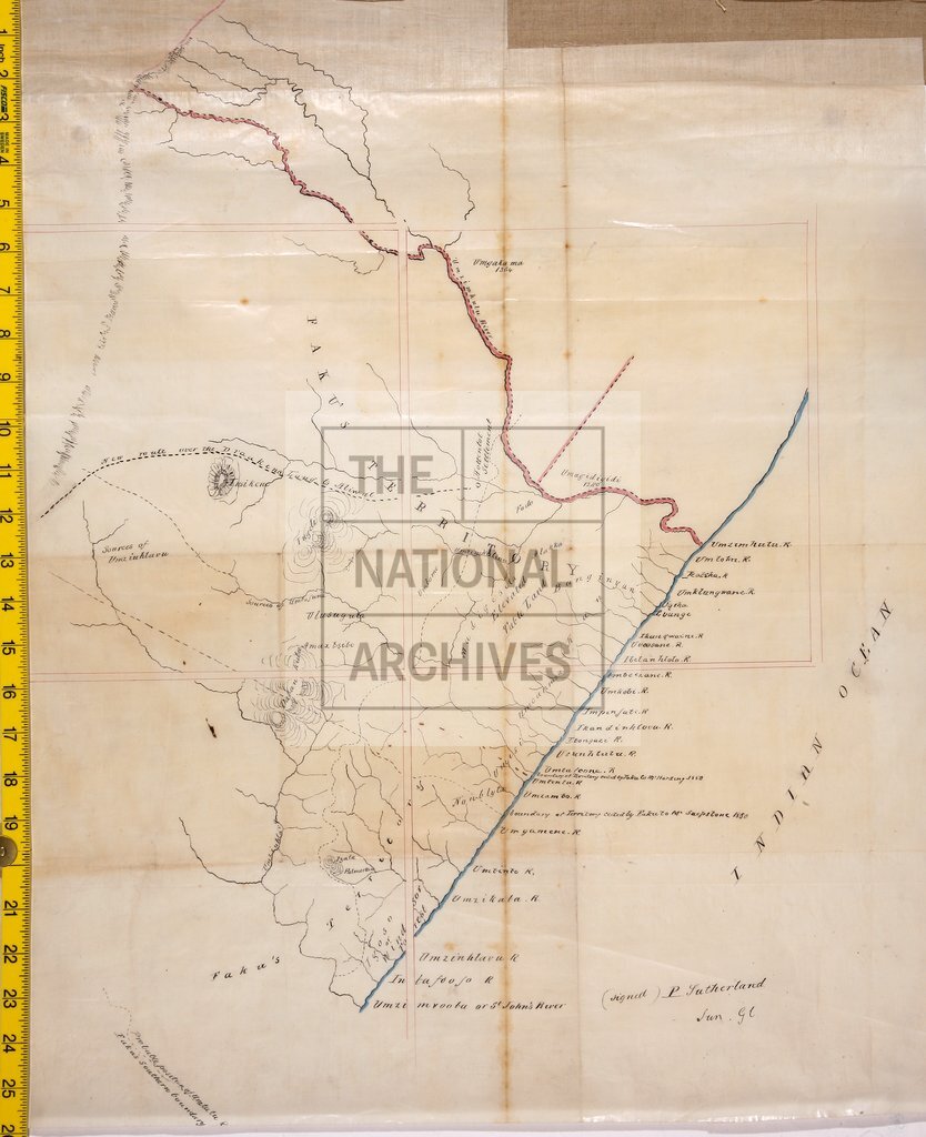
Territory controlled by Faku, Chief of the Mpondo, Southern Africa
Date:
1863
Reference:
MR 1/32/1
Creator:
Maps and plans extracted to rolled storage from records of various departments
Catalogue context:
Southern Africa (areas now in Eastern Cape and KwaZulu/Natal provinces, South Africa). Sketch map of territory controlled by Faku [Chief of the Mpondo], between the Umzimkulu and the Umzimvubu Rivers, showing the boundaries of territories ceded to Mr Harding and Mr Shepstone in 1850. Signed: P Sutherland, Surveyor General.
Categories:
Maps and plans; Overseas
Subjects:
Africa; Archives and libraries; Maps and plans
Topics:
International trade and affairs; Land and buildings
Period:
Victorians
Places:
Africa
Copyright information:
Copyright clearance for publication is not required, except in the case of documents in third-party copyright.
Usage terms:
https://www.nationalarchives.gov.uk/documents/information-management/use-of-tna-materials.pdf