Chart of the English Channel
Date:
1815
Reference:
MR 1/34 (left)
Creator:
Maps and plans extracted to rolled storage from records of various departments
Catalogue context:
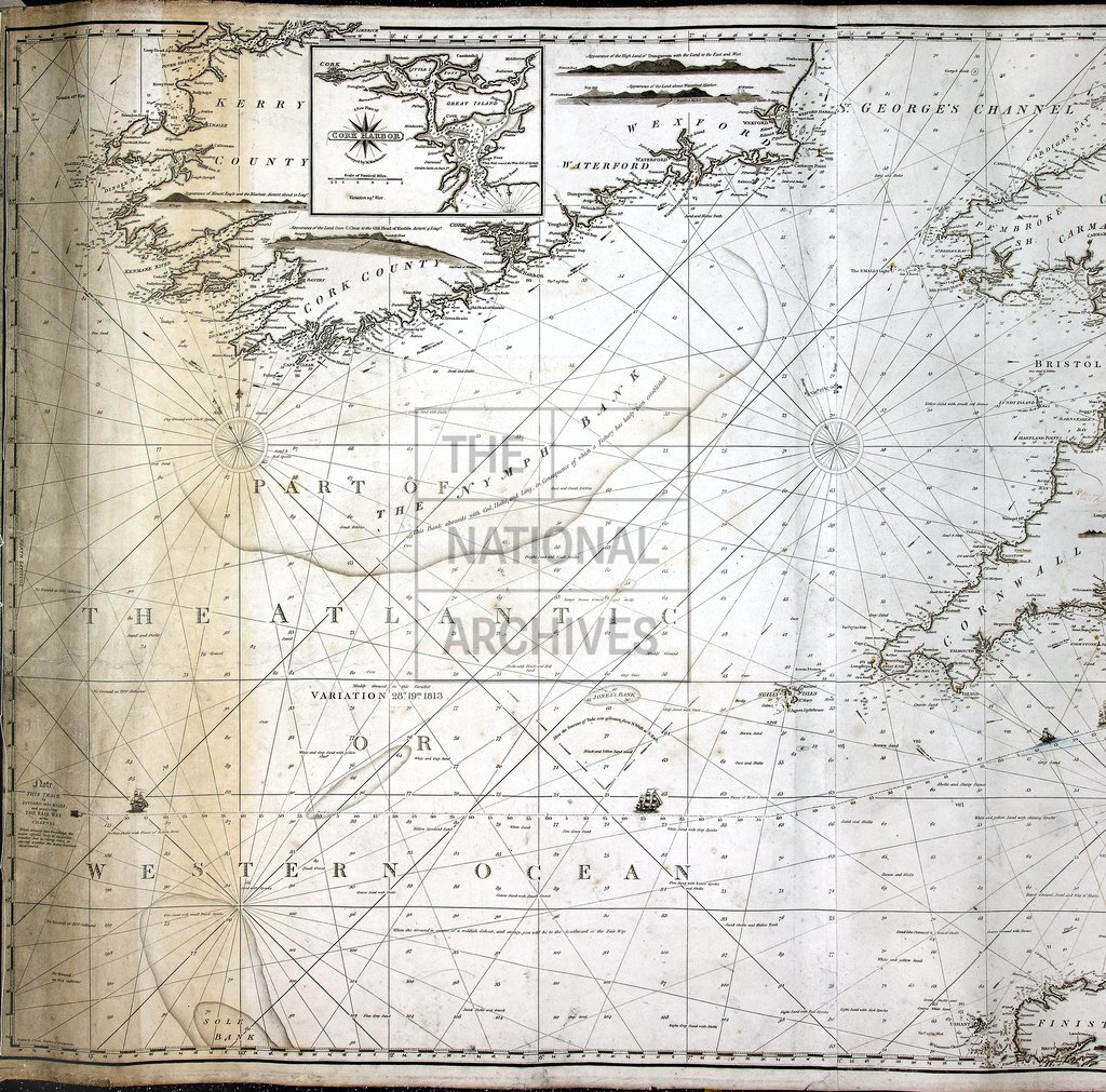
'Chart of the English Channel', with inset charts of Cork Harbour, Dartmouth, Falmouth, Margate Roads, Plymouth, Portsmouth and Tor Bay. Shows soundings, shoals, nature of sea-bed, views of coast and lighthouses. Scale: 1 inch to about 9 miles. Compass indicators. Dedicated to the Master, etc, of Trinity House by William Heather. Engraved by [-] Stephenson. Compiled and published by J W Norie, Hydrographer, the Navigation Warehouse, 157 Leadenhall Street, London, 1 January 1815.
Categories:
Maps and plans
Subjects:
Archives and libraries; Maps and plans
Topics:
Land and buildings
Period:
Empire And Industry
Copyright information:
Copyright clearance for publication is not required, except in the case of documents in third-party copyright.
Usage terms:
https://www.nationalarchives.gov.uk/documents/information-management/use-of-tna-materials.pdf