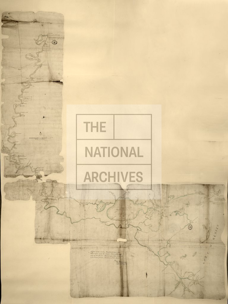
Lakes Ponchartrain and Maurepas and the River Iberville
Date:
1779
Reference:
MR 1/107
Creator:
Maps and plans extracted to rolled storage from records of various departments
Catalogue context:
1 item (enclosure to despatch from Captain Hutchins, 24 January 1779) extracted from CO 5/595 (folio 641A). North America. 'A Plan of the Lakes Ponchartrain and Maurepas and the River Ibberville [sic, Iberville] and also of the River Mississippi from its Mouth to the River Yazou [Yazoo]. A Distance of 450 Miles. By Tho. Hutchins Captain 60th Regiment': map (of territory now in Louisiana, United States of America) showing place names and the nature of the country. Scale: 1 inch to 4 miles. Compass indicator.
Categories:
Maps and plans
Subjects:
Americas; Archives and libraries; Army; Maps and plans
Topics:
International trade and affairs; Land and buildings; Military and war
Period:
Empire And Industry
Copyright information:
Copyright clearance for publication is not required, except in the case of documents in third-party copyright.
Usage terms:
https://www.nationalarchives.gov.uk/documents/information-management/use-of-tna-materials.pdf