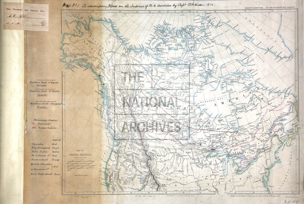
British North America, Captain Blakiston's route in 1857, and his route from the Red River south of Lake Winnipeg to the Kootenay Fork 1859
Date:
1857-1859
Reference:
MR 1/109/1
Creator:
Maps and plans extracted to rolled storage from records of various departments
Catalogue context:
North America. Map showing lands belonging to Great Britain, Russia, the United States of America, and the Hudson's Bay Company. Scale: 1 inch to about 180 miles. By J Arrowsmith; ordered by the House of Commons to be printed, 31 July and 11 August, 1857. MS additions, coloured, highlighting boundaries and showing the southern limits of barren ground and ground with frozen subsoil, the northern limit of original prairie, and the sites of Roman Catholic and Protestant mission stations; MS reference table.
Categories:
Maps and plans
Subjects:
Americas; Archives and libraries; Army; Asia; Europe and Russia; Maps and plans; Trade and commerce
Topics:
International trade and affairs; Land and buildings; Military and war
Period:
Victorians
Copyright information:
Copyright clearance for publication is not required, except in the case of documents in third-party copyright.
Usage terms:
https://www.nationalarchives.gov.uk/documents/information-management/use-of-tna-materials.pdf