Halifax harbour Nova Scotia
Date:
1827
Reference:
MR 1/143/3 (left half)
Creator:
Maps and plans extracted to rolled storage from records of various departments
Catalogue context:
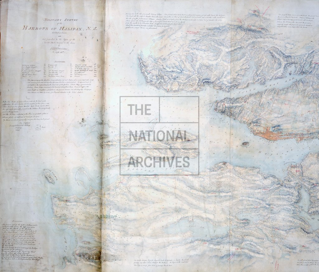
Nova Scotia (now part of Canada). 'Military Survey of the Harbour of Halifax, N.S.... presented to the office of the Quarter Master General to the forces ...': map covering the whole of Bedford Basin and areas as far south as Devil's Island. Reference table to buildings, forts, batteries and prominent hills; extensive reference notes on the natures of the terrain, including altitudes, fortifications, roads, an intended canal to the Minas Basin, and soundings. Scale 6 inches to 1 mile. Compass indicator; west-south-west at the top. By Captain W S Moorsom, 52nd Light Infantry. MS addition expressing the scale as a ratio. Inset: view of the harbour between Point Pleasant and the Narrows, taken from a point near the Eastern battery.
Categories:
Maps and plans
Subjects:
Americas; Archives and libraries; Army; Canals and river transport; Maps and plans
Topics:
International trade and affairs; Land and buildings; Military and war; Transport and travel
Period:
Empire And Industry
Copyright information:
Copyright clearance for publication is not required, except in the case of documents in third-party copyright.
Usage terms:
https://www.nationalarchives.gov.uk/documents/information-management/use-of-tna-materials.pdf