Expedition to Holland by the United British and Russian Armies
Date:
1799
Reference:
MR 1/164/14 (left half)
Creator:
Maps and plans extracted to rolled storage from records of various departments
Catalogue context:
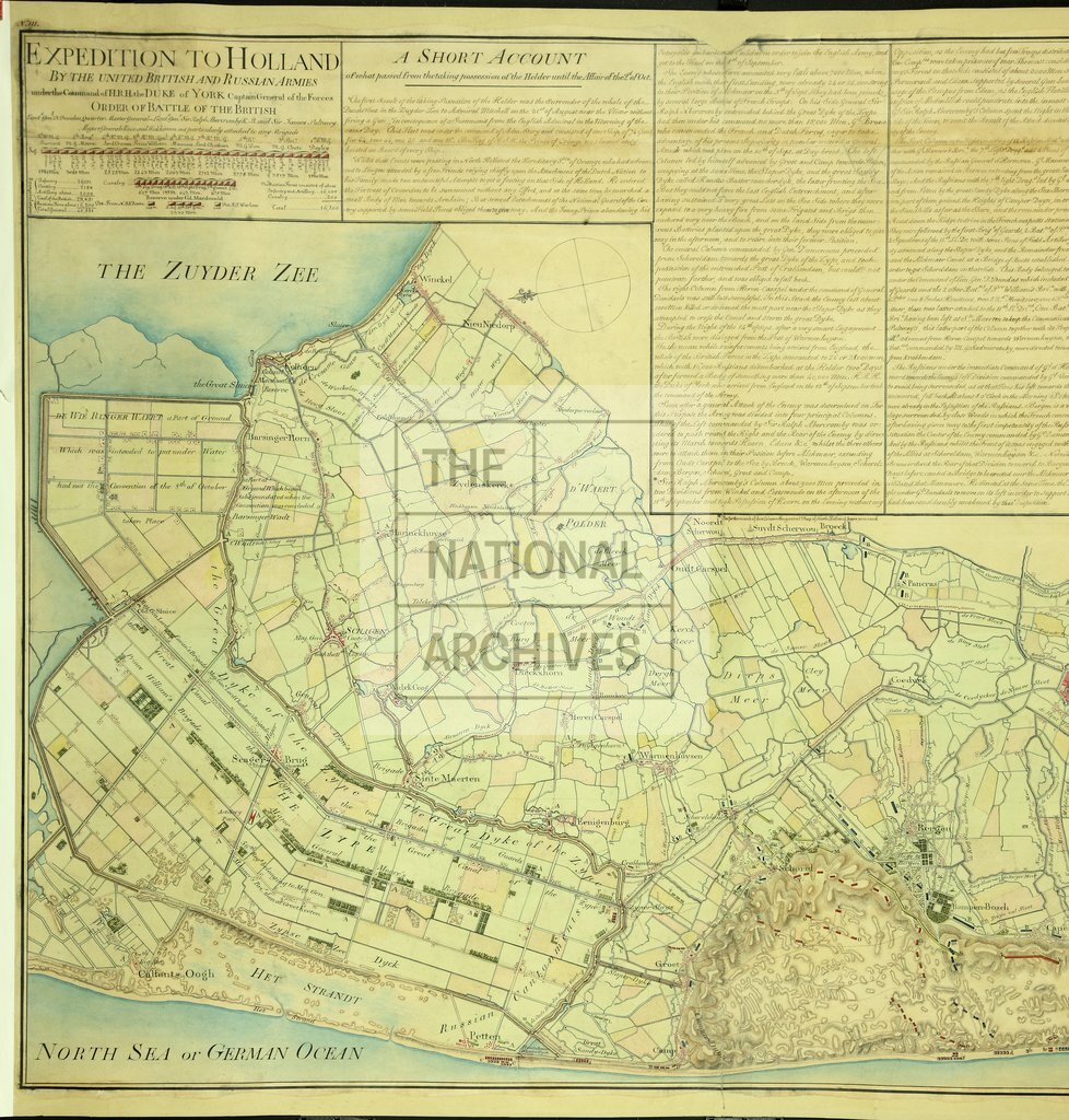
Batavian Republic (now The Netherlands): North Holland. 'Expedition to Holland by the United British and Russian Armies under the Command of H.R.H. the Duke of York Captain General of the Forces': map of the area between Callantsoog and Beverwijk, showing the positions of allied and French troops. Scale: 1 inch to about 0.438 miles. Compass rose. The sheet also bears the text of the British Order of Battle; 'A Short Account of what passed from the taking possession of the Helden until the Affair of the 2d of Oct. [1799]'; and an 'Explanation of the Action Fought on the 2d of October'. MS addition, expressing the scale inaccurately as the ratio 1:21,132.
Categories:
Maps and plans; Overseas
Subjects:
Archives and libraries; Armed Forces (General Administration); Europe and Russia; Maps and plans
Topics:
International trade and affairs; Land and buildings; Military and war
Period:
Empire And Industry
Places:
Russia
Copyright information:
Copyright clearance for publication is not required, except in the case of documents in third-party copyright.
Usage terms:
https://www.nationalarchives.gov.uk/documents/information-management/use-of-tna-materials.pdf