Epping Forest
Date:
1772-1880
Reference:
MR 1/180 (63)
Creator:
Maps and plans extracted to rolled storage from records of various departments
Catalogue context:
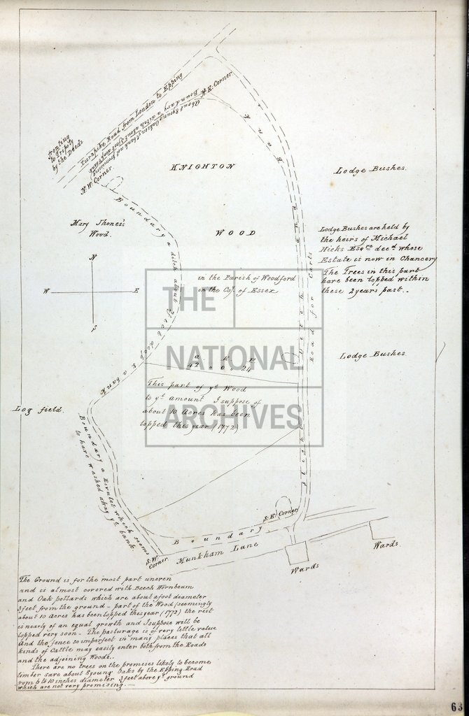
10 maps and plans, numbered (59)-(68), of miscellaneous holdings in Epping Forest, Essex, in the parishes of Chingford, Epping, Leytonstone, Loughton, Walthamstow, Wanstead and Woodford. Item (66) is a 19th century tracing of a 17th century map, by Richard Danes, of Epping Bury, Essex, showing the demesne lands in the possession of Sir Thomas Finch, Earl of Winchelsea and Viscount Maidstone; whereabouts of the original map not specified.
Categories:
Maps and plans
Subjects:
Archives and libraries; Maps and plans
Topics:
Agriculture and environment; Land and buildings
Period:
Empire And Industry
Copyright information:
Copyright clearance for publication is not required, except in the case of documents in third-party copyright.
Usage terms:
https://www.nationalarchives.gov.uk/documents/information-management/use-of-tna-materials.pdf