Wychwood Forest
Date:
1792
Reference:
MR 1/277 (right half)
Creator:
Maps and plans extracted to rolled storage from records of various departments
Catalogue context:
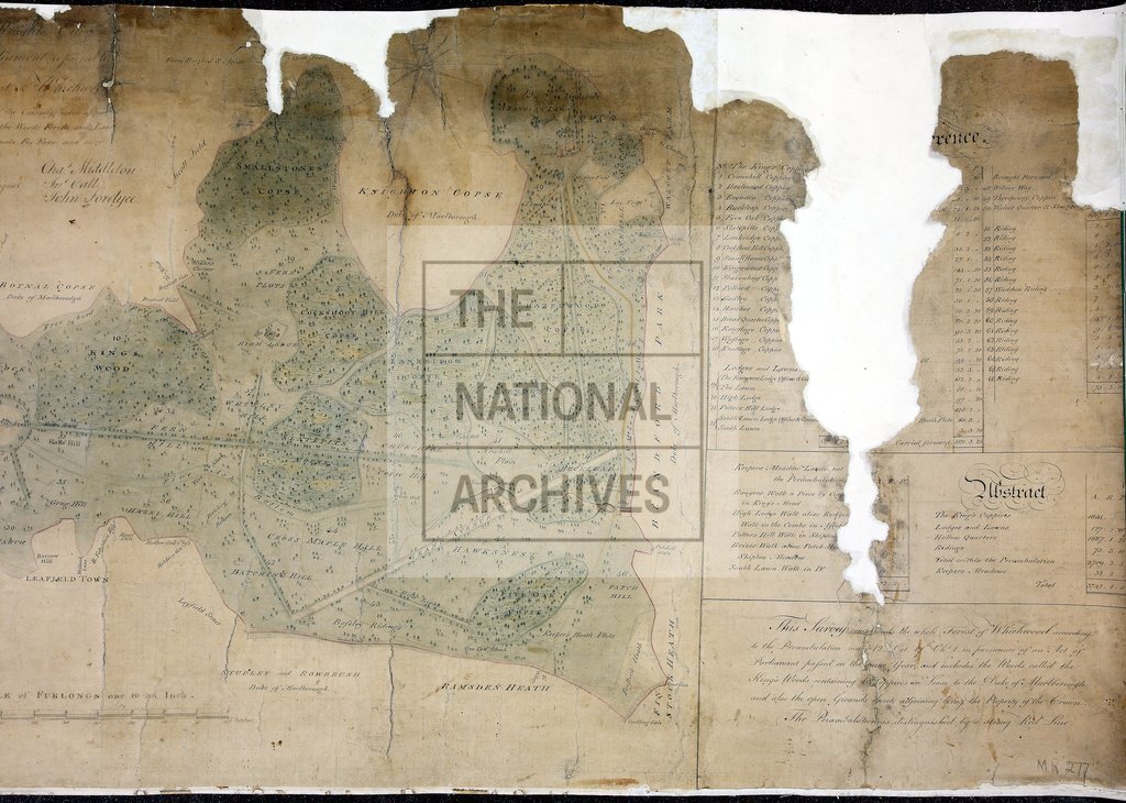
Oxfordshire. Map of Wychwood Forest, from a survey made by order of the Commissioners of Land Revenue, showing the extent of the forest according to the perambulation made in 1641. Coppice and field names are also shown. Reference table. Scale: 1 inch to 1 furlong. Compass indicator. Drawn by Robert Gray and presented to Parliament February 1792.
Categories:
Maps and plans
Subjects:
Archives and libraries; Forestry; Maps and plans
Topics:
Agriculture and environment; Land and buildings
Period:
Empire And Industry
Copyright information:
Copyright clearance for publication is not required, except in the case of documents in third-party copyright.
Usage terms:
https://www.nationalarchives.gov.uk/documents/information-management/use-of-tna-materials.pdf