Yoruba, Africa
Date:
1890
Reference:
MR 1/450
Creator:
Maps and plans extracted to rolled storage from records of various departments
Catalogue context:
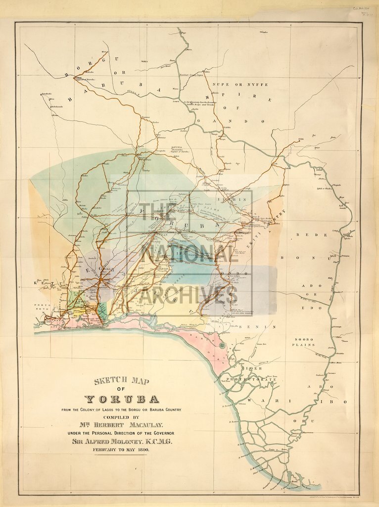
1 item extracted from CO 879/33 (between pages 96 and 97). West Africa. 'Sketch map of Yoruba, from the Colony of Lagos to the Borgu or Baruba Country ...': showing rivers, towns, villages and farms; (the territory covered is now in Nigeria and Benin). Reference notes on the nature of the terrain. Scale: 1 inch to about 12 miles. 'Compiled by Mr. Herbert Macaulay under the personal direction of the Governor, Sir Alfred Moloney K.C.M.G., February to May 1890'; lithographed by Judd and Co; printed June 1890.
Categories:
Maps and plans; Overseas
Subjects:
Africa; Archives and libraries; Farming; Maps and plans
Topics:
Agriculture and environment; International trade and affairs; Land and buildings
Period:
Victorians
Places:
Africa
Copyright information:
Copyright clearance for publication is not required, except in the case of documents in third-party copyright.
Usage terms:
https://www.nationalarchives.gov.uk/documents/information-management/use-of-tna-materials.pdf