Burwell, Cambridge
Date:
1806
Reference:
MR 1/509
Creator:
Maps and plans extracted to rolled storage from records of various departments
Catalogue context:
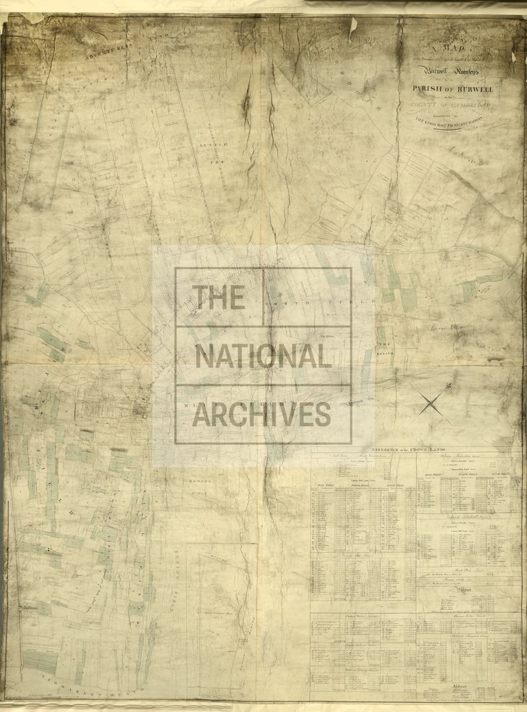
Cambridgeshire. Map of Burwell demesne and copyhold lands in the manor of Burwell Ramseys showing names of proprietors and roads. Reference table to Crown lands with tenants and acreage. Scale: 1 inch to 6 chains. Compass indicator. Surveyed by W Custance, Cambridge.
Categories:
Maps and plans
Subjects:
Archives and libraries; Crown lands and estates; Manors; Maps and plans
Topics:
Land and buildings
Period:
Empire And Industry
Copyright information:
Copyright clearance for publication is not required, except in the case of documents in third-party copyright.
Usage terms:
https://www.nationalarchives.gov.uk/documents/information-management/use-of-tna-materials.pdf