Fort Pitt, Pittsburgh, Pennsylvania
Date:
1761
Reference:
MR 1/518 (2)
Creator:
Maps and plans extracted to rolled storage from records of various departments
Catalogue context:
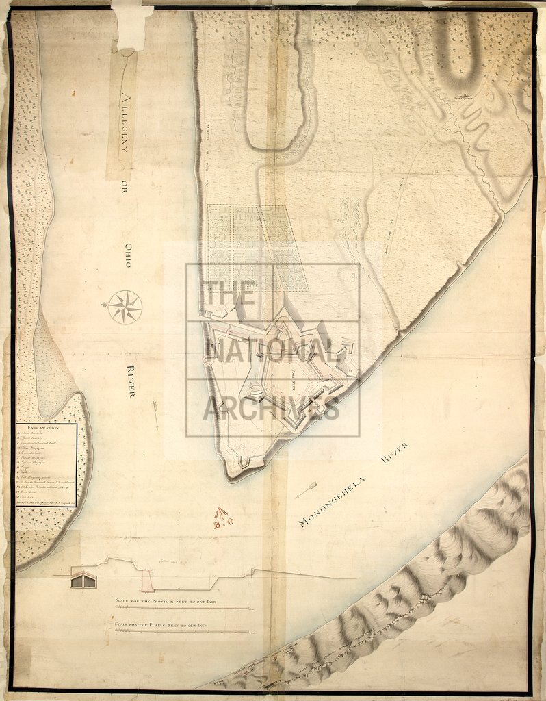
Pennsylvania (now part of the United States of America): Fort Pitt (now the Golden Triangle, Pittsburgh). Two copies of a plan of the existing fort and surrounding area, showing limehouses and kilns, a stone quarrry and coal pit, the the detailed layout of a neighbouring garden, the ruins of Fort Duquesne and the site of the English fort built in the winter of 1758-1759, the old and new roads to Fort Ligonier, and the confluence of the Allegheny and Monongahela Rivers to form the Ohio River. Reference table to defence works and buildings. Scale: 1 inch to 100 feet. Compass rose; east at the top. Surveyed by Lieutenant Elias Meyer, Engineer, 1st Battalion, Royal American Regiment; item (1) copied by William Twiss. Inset: a section on the line ABC; scale: 1 inch to 10 feet [1:120].
Categories:
Maps and plans
Subjects:
Americas; Archives and libraries; Army; Coal; Maps and plans
Topics:
Business, finance and innovation; International trade and affairs; Land and buildings; Military and war
Period:
Empire And Industry
Copyright information:
Copyright clearance for publication is not required, except in the case of documents in third-party copyright.
Usage terms:
https://www.nationalarchives.gov.uk/documents/information-management/use-of-tna-materials.pdf