Cape Charles, Virginia, to Cape Sable, Florida c1775
Date:
1775
Reference:
MR 1/919 (6 of 8)
Creator:
Maps and plans extracted to rolled storage from records of various departments
Catalogue context:
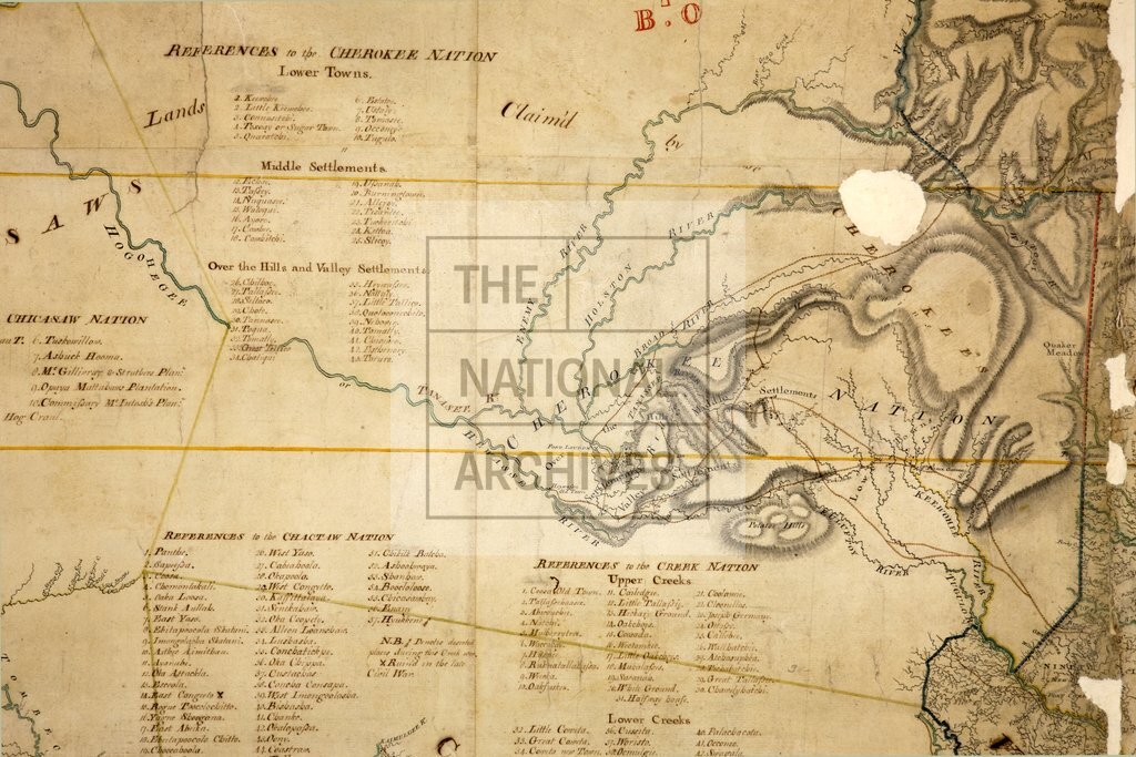
Map of North America, consisting of two joined and repaired fragments, together covering the area (now in the United States of America) between Cape Charles, Virginia, in the north-east, Cape Sable, Florida, in the south-east, and the Mississippi River in the west; showing rivers, mountains, place names, British and Spanish territory, and land occupied and claimed by native peoples; much of the northern part of the map, including the title and most of Virginia, is missing. Reference table to the settlements of the Choctaw, Creek, Chickasaw and Cherokee nations. Scale: 1 inch to 16 miles. Compass indicator. [Compiled by John Stuart, Superintendent of Indian Affairs]. The western (formerly WO 78/1638) and eastern (formerly WO 78/2695) fragments were held individually in the records of the War Office and transferred to the Public Record Office as separate maps. They were reunited and placed together on this roller in November 1950.
Categories:
Maps and plans
Subjects:
Americas; Archives and libraries; Armed Forces (General Administration); Army; Maps and plans; Operations, battles and campaigns
Topics:
International trade and affairs; Land and buildings; Military and war
Period:
Empire And Industry
Copyright information:
Copyright clearance for publication is not required, except in the case of documents in third-party copyright.
Usage terms:
https://www.nationalarchives.gov.uk/documents/information-management/use-of-tna-materials.pdf