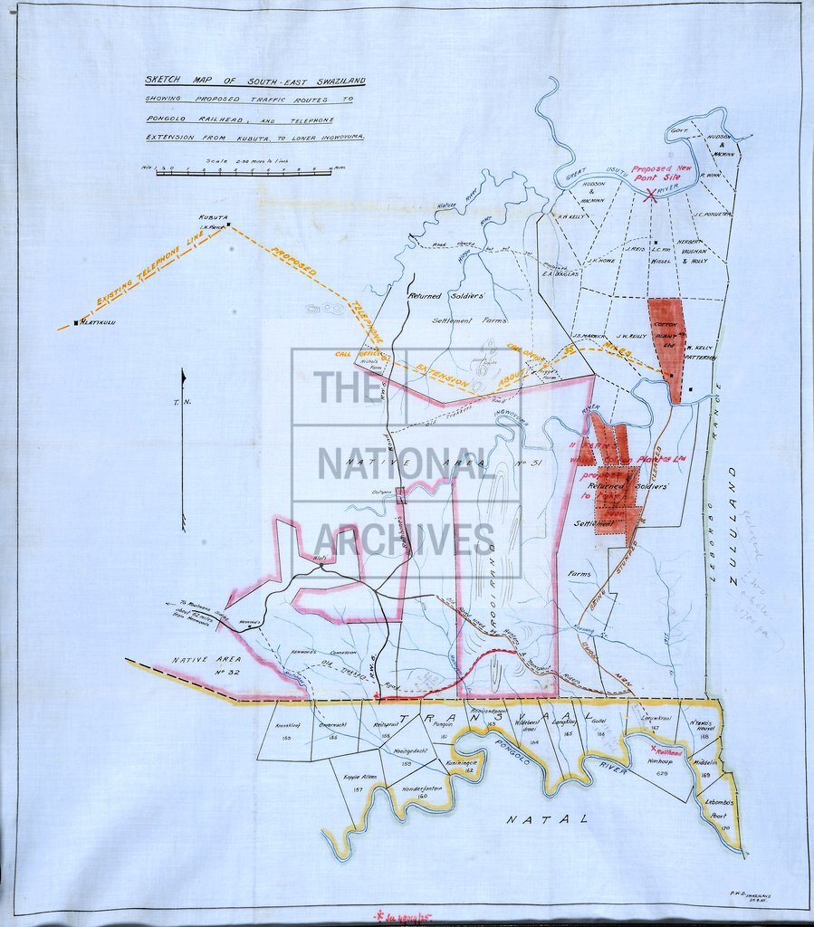
South-East Swaziland, showing proposed traffic routes to Pongolo
Date:
1925
Reference:
MR 1/998/1
Creator:
Maps and plans extracted to rolled storage from records of various departments
Catalogue context:
'Sketch Map of South-East Swaziland, showing proposed traffic routes to Pongolo [i.e. Pongola, Natal (now KwaZulu-Natal province), South Africa] railhead and telephone extension from Kubuta to Lower Ingwovuma [i.e. Ingwavuma]': also showing land reserves, with their owners' names. Scale: 1 inch to 2.34 miles. Compass indicator. [By] the Public Works Department, Swaziland, 25 August 1925.
Categories:
Maps and plans
Subjects:
Africa; Archives and libraries; Communications; Construction industries; Maps and plans
Topics:
Arts and culture; International trade and affairs; Land and buildings
Period:
Interwar
Copyright information:
Copyright clearance for publication is not required, except in the case of documents in third-party copyright.
Usage terms:
https://www.nationalarchives.gov.uk/documents/information-management/use-of-tna-materials.pdf