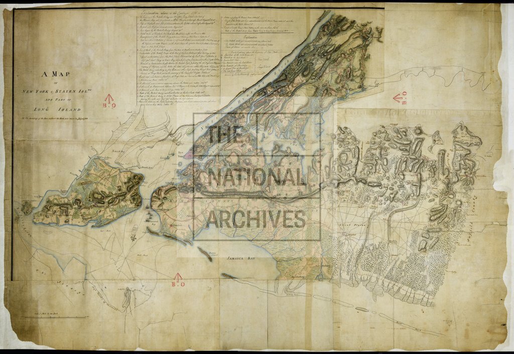
Map of New York, Staten Islands and part of Long Island. Drawn by Charles Blaskowitz
Date:
1782
Reference:
MR 1/1137
Creator:
Maps and plans extracted to rolled storage from records of various departments
Catalogue context:
'A Map of New York [i.e. Manhattan] & Staten Islds and Part of Long Island. Drawn by Charles Blaskowitz, Capt. Guides & P [Pioneers].': also covering part of the New Jersey coast; (the area depicted is now in the United States of America); showing refugee posts (one dated 21 July 1780) on the New Jersey shore of the Hudson River, and soundings around Sandy Hook. Reference table to redoubts and fortifications; detailed reference notes on a military campaign of 1776. Decorative drawings of ships. Scale: 1 inch to 1 mile. Compass indicator. Soundings taken in July 1782.
Categories:
Maps and plans; Overseas
Subjects:
Americas; Archives and libraries; Conflict; Maps and plans; Operations, battles and campaigns; Refugees
Topics:
International trade and affairs; Land and buildings; Military and war
Period:
Empire And Industry
Places:
Americas
Copyright information:
Copyright clearance for publication is not required, except in the case of documents in third-party copyright.
Usage terms:
https://www.nationalarchives.gov.uk/documents/information-management/use-of-tna-materials.pdf