Woolwich Common, Oxleas Wood and Eltham High Street, Eltham, Kent
Date:
1807
Reference:
MR 1/1340
Creator:
Maps and plans extracted to rolled storage from records of various departments
Catalogue context:
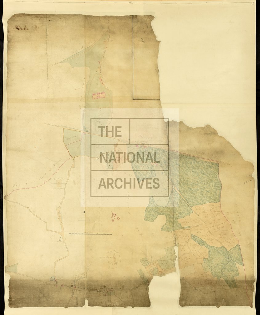
Kent: Eltham. Map of the area (now in the London Borough of Greenwich) bewteen Woolwich Common, Oxleas Wood and Eltham High Street, showing roads, acreages, field names, landowners' names, and crown land, including an area leased to Sir John Shore. Scale: 1 inch to 4 chains. Compass indicator. A note on the dorse states that [the crown land on] this map was copied from a map lent to General Morse by the Land Revenue Office.
Categories:
Maps and plans
Subjects:
Archives and libraries; Crown lands and estates; Maps and plans
Topics:
Land and buildings
Period:
Empire And Industry
Copyright information:
Copyright clearance for publication is not required, except in the case of documents in third-party copyright.
Usage terms:
https://www.nationalarchives.gov.uk/documents/information-management/use-of-tna-materials.pdf