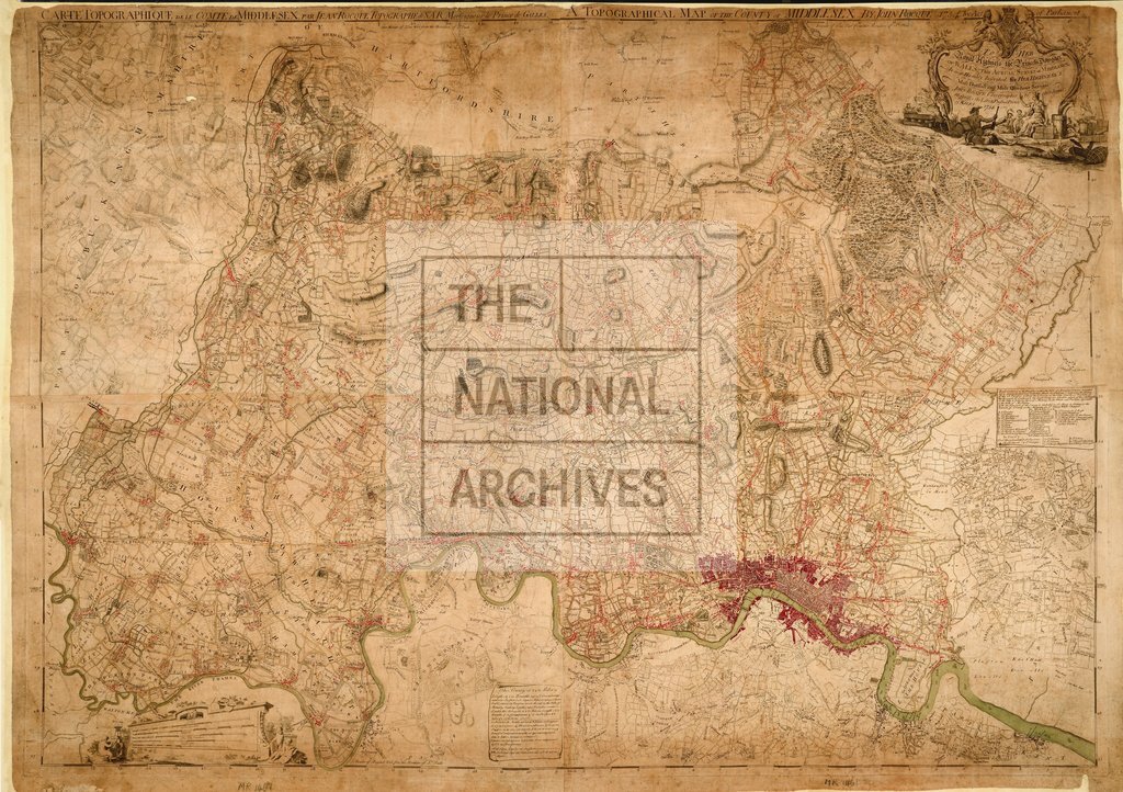
Topographical map of the county of Middlesex. Surveyed by John Rocque 1754.
Date:
1754
Reference:
MR 1/1461
Creator:
Maps and plans extracted to rolled storage from records of various departments
Catalogue context:
'A Topographical Map of the County of Middlesex' including the City of London. Reference table. Scale: 1 inch to 0.5 mile. Surveyed by John Rocque. Dedicated to the Princess Dowager of Wales.
Categories:
Maps and plans
Subjects:
Archives and libraries; Maps and plans
Topics:
Land and buildings
Period:
Empire And Industry
Copyright information:
Copyright clearance for publication is not required, except in the case of documents in third-party copyright.
Usage terms:
https://www.nationalarchives.gov.uk/documents/information-management/use-of-tna-materials.pdf