Boughton or Grand River, Prince Edward Island
Date:
1843-1862
Reference:
MR 1/1789/30
Creator:
Maps and plans extracted to rolled storage from records of various departments
Catalogue context:
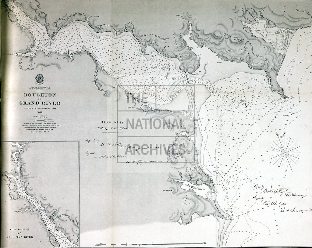
Prince Edward Island (now a province of Canada). 'Boughton or Grand River surveyed by Captn. H. W. Bayfield, R.N., F.A.S. 1843': map. Scale: 1 inch to about 500 yards. Compass rose. Engraved by J and C Walker; published 15 September 1850. Inset: continuation north-west. MS title: 'Plan No. 32 Fishery Commission': MS additions [?showing fishing limits]. Signed by the American and British commissioners and surveyors.
Categories:
Maps and plans
Subjects:
Americas; Archives and libraries; Fishing; Maps and plans
Topics:
Agriculture and environment; International trade and affairs; Land and buildings
Period:
Empire And Industry
Copyright information:
Copyright clearance for publication is not required, except in the case of documents in third-party copyright.
Usage terms:
https://www.nationalarchives.gov.uk/documents/information-management/use-of-tna-materials.pdf