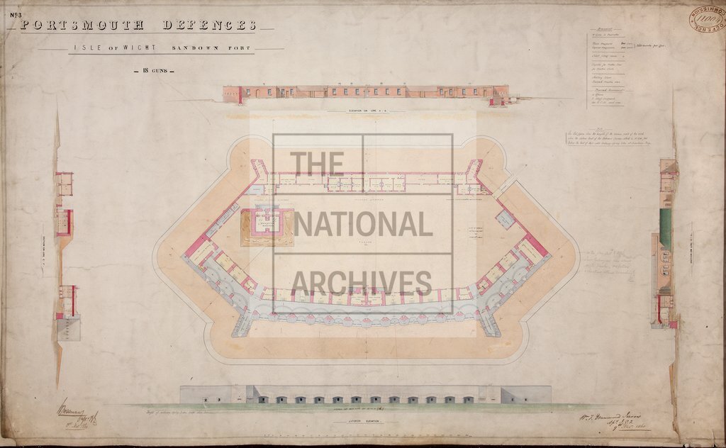
Sandown Fort, Isle of Wight
Date:
1860
Reference:
MR 1/1850 (9)
Creator:
Maps and plans extracted to rolled storage from records of various departments
Catalogue context:
22 maps and drawings showing fortifications on the Isle of Wight, constructed as part of the defences of Portsmouth, Hampshire, with accompanying memoranda. Detailed descriptions are given at item level.
Categories:
Maps and plans
Subjects:
Archives and libraries; Maps and plans
Topics:
Land and buildings
Period:
Victorians
Copyright information:
Copyright clearance for publication is not required, except in the case of documents in third-party copyright.
Usage terms:
https://www.nationalarchives.gov.uk/documents/information-management/use-of-tna-materials.pdf