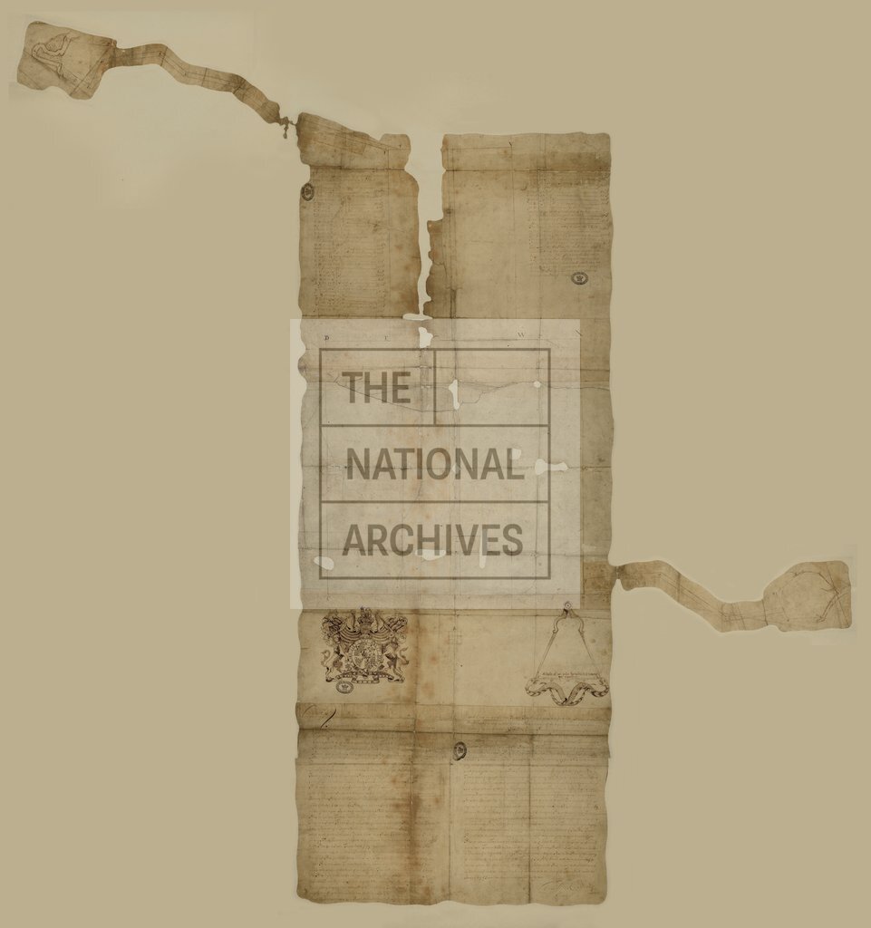
Williamsburg showing Queen Mary's Port and Princess Ann's Port
Date:
1699
Reference:
MR 1/2067
Creator:
Maps and plans extracted to rolled storage from records of various departments
Catalogue context:
1 item (originally enclosed with a letter from Governor General Nicholson, 1 July 1699) extracted from CO 5/1310 . Virginia (now part of the United States of America): Williamsburg. Outline map of the town, showing the College [of William and Mary] and the roads to the landing places at Queen's Creek and Archer's Hope Creek. Reference tables to boundary courses and distances; descriptive reference note on boundaries. Decorated with the royal coat of arms and a pair of entwined snakes. Scale: 1 inch to about 2 chains. Endorsed with the title: 'Draught of the City of Williamsburgh, of Queen Mary's Port and Princess Ann's Port'. The positions of the ports mentioned on the dorse are not identified explicitly on the face; they are presumably the two creeks marked on the map.
Categories:
Maps and plans
Subjects:
Americas; Archives and libraries; Maps and plans
Topics:
International trade and affairs; Land and buildings
Period:
Early Modern
Copyright information:
Copyright clearance for publication is not required, except in the case of documents in third-party copyright.
Usage terms:
https://www.nationalarchives.gov.uk/documents/information-management/use-of-tna-materials.pdf