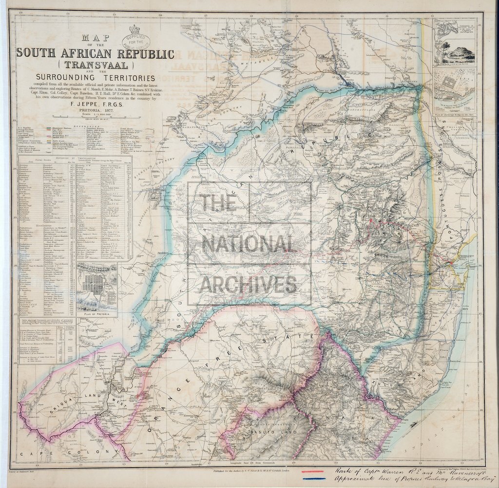
Transvaal and the surrounding Territories
Date:
1877
Reference:
MFQ 1/548/1
Creator:
Maps and plans extracted to flat storage from records of various departments held at the Public Record Office, Kew
Catalogue context:
'Map of South African Republic (Transvaal) and the surrounding Territories ...': (covering areas now in South Africa, Botswana, Lesotho, Mozambique, Swaziland and Zimbabwe), showing boundaries, missionary stations, the limit of the tsetse fly, and travellers' routes and possessions. Reference table; table of distances; table referring to distances and heights of a projected railway from Lourenço Marques (now Maputo) to Drakensberg. Compiled by F Jeppe, Fellow of the Royal Geographical Society; engraved by Edward Weller, Fellow of the Royal Geographical Society; published by S W Silver, Cornhill, London. Insets: plans of Pretoria and Lourenço Marques; map of C Mauch's route to Great Zimbabwe, September 1871, with a view of the ruins. MS additions, coloured, showing the route of Captain Warren, Royal Engineers, and Mr Ravenscroft, and the approximate line of a proposed railway from Kimberley to Delagoa Bay (now Maputo Bay) via Pretoria; reference table to additions.
Categories:
Maps and plans
Subjects:
Africa; Archives and libraries; Army; Maps and plans; Railways
Topics:
International trade and affairs; Land and buildings; Military and war; Transport and travel
Period:
Victorians
Copyright information:
Copyright clearance for publication is not required, except in the case of documents in third-party copyright.
Usage terms:
https://www.nationalarchives.gov.uk/documents/information-management/use-of-tna-materials.pdf