Port Royal, Jamaica, before and after the earthquake of 1692, 1870
Date:
1692-1870
Reference:
MFQ 1/931
Creator:
Maps and plans extracted to flat storage from records of various departments held at the Public Record Office, Kew
Catalogue context:
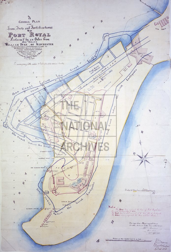
1 item extracted from CO 137/452 (folio 20). 'A General Plan of the Town Forts and Fortifications etc. of Port Royal Perform'd by an Order from His Grace William Duke of Manchester, Captain General and Governor in Chief of His Majesty's Island of Jamaica and the territories thereon depending in America, Chancellor and Vice Admiral of the Same. Surveyed in June 1827 by Phillip A Morris, Crown Surveyor': showing the sea coast, buildings, wharfs, streets, channels and gardens, as existing before and after the great earthquake of 1692. Reference notes to colouring and the original survey. Scale: 1 inch to 100 feet. Compass star. Copy of a plan produced in 1827. Signed: Thomas Harrison, Government Surveyor, [Spanish Town], 20 September 1870, and [Colonel] J R Mann, [Surveyor General], 24 October 1870. Originally enclosure number 2 accompanying Harrison's report on the earthquake, sent to Mann 18 October 1870; subsequently enclosed in Mann's letter to the Colonial Secretary, 31 October 1870.
Categories:
Maps and plans; Overseas
Topics:
Land and buildings
Period:
Early Modern
Places:
Caribbean
Copyright information:
Copyright clearance for publication is not required, except in the case of documents in third-party copyright.
Usage terms:
https://www.nationalarchives.gov.uk/documents/information-management/use-of-tna-materials.pdf