French settlements India
Date:
1949
Reference:
MFQ 1/1144 (2)
Creator:
Maps and plans extracted to flat storage from records of various departments held at the Public Record Office, Kew
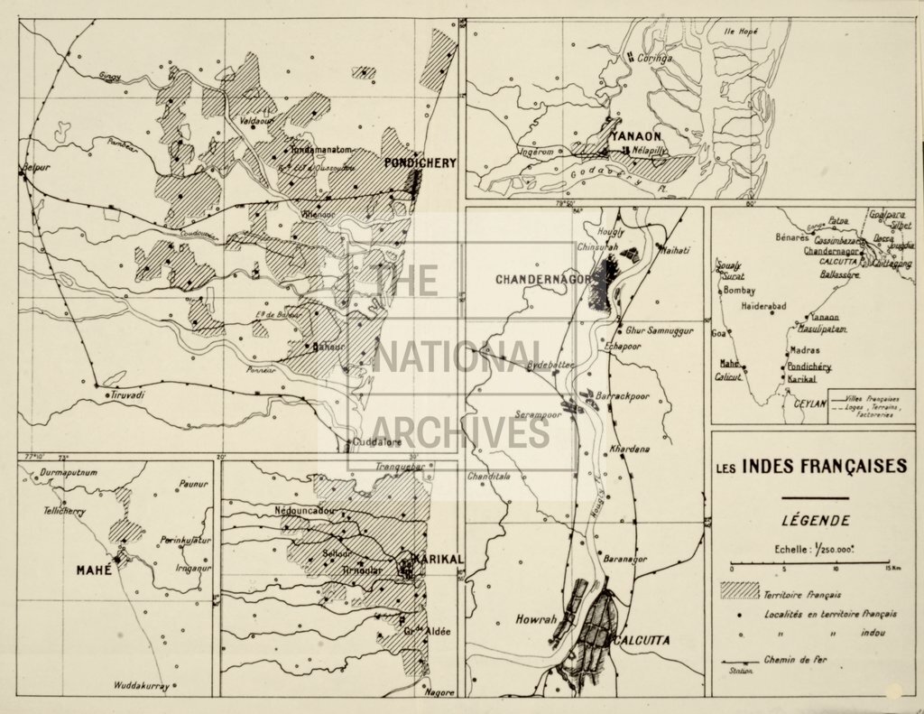
Catalogue context:
2 items extracted from FO 371/76086 . Southern India. 2 sheets of maps of French enclaves (now administered by India as the Union Territory of Pondicherry). (1) 'Pondichery Et Ses Environs': map of the area to the east of the city of Pondicherry, showing villages, rivers, roads, railways and French-governed areas. Scale: 1 inch to 1.58 miles. Compass indicator. (2) 'Les indes Françaises': sheet bearing 6 small maps, showing: Pondicherry and the South Arcot region, Mahe, Karaikal, Yanam, Chandannagar and Calcutta (Kolkata), and the whole country with the positions of the French enclaves marked. Reference table. Scale: 1 inch to 4.35 miles. Sheet sizes: (1) 50 cm x 46 cm; (2) 28 cm x 36 cm.
Categories:
Maps and plans; Overseas
Subjects:
Archives and libraries; Indian Subcontinent; Maps and plans; Railways
Topics:
International trade and affairs; Land and buildings; Transport and travel
Period:
Postwar
Places:
France; India
Copyright information:
Copyright clearance for publication is not required, except in the case of documents in third-party copyright.
Usage terms:
https://www.nationalarchives.gov.uk/documents/information-management/use-of-tna-materials.pdf