E Mediterranean, West Black Sea, Crete, Cyprus, Greece, Turkey, coast of Bulgaria, Romania, and Crimea, early 14 century
Date:
1300-1340
Reference:
MPB 1/38
Creator:
Maps and plans extracted to flat storage from records of the Exchequer
Catalogue context:
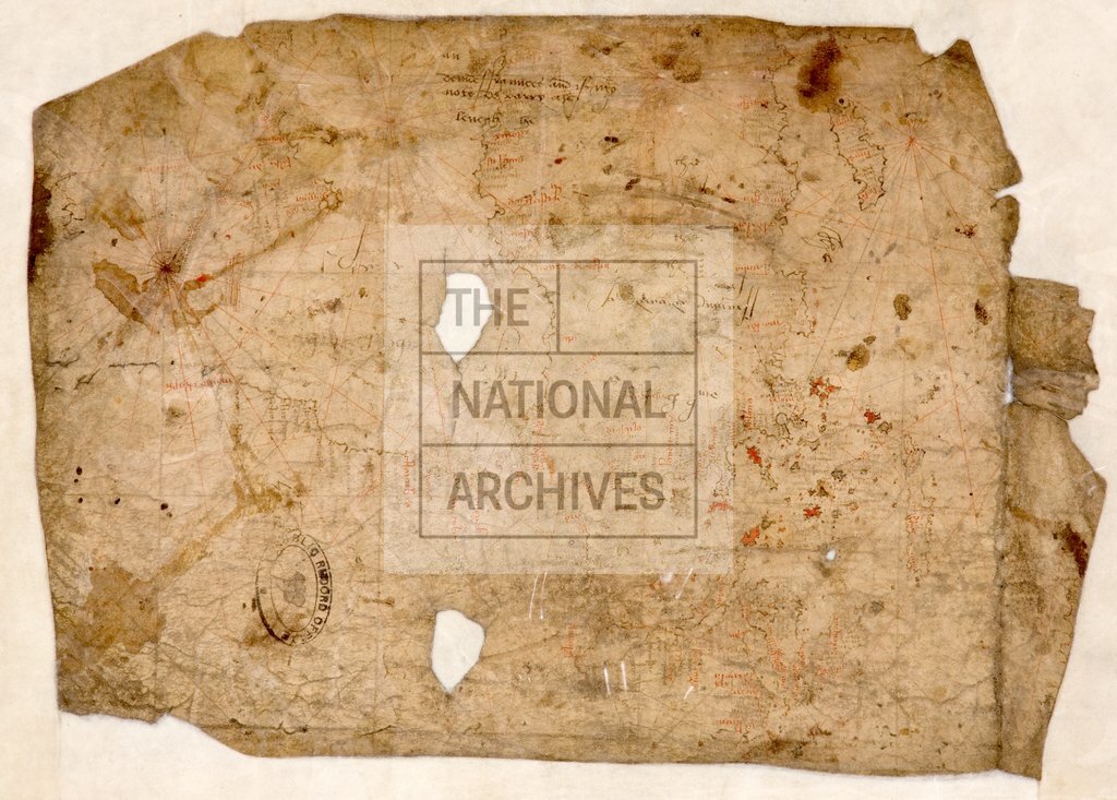
1 item extracted from E 122/165/10 . Part of a portolan chart of the eastern Mediterranean and the western Black Sea, showing Crete, Cyprus, Greece, Turkey, the coasts of Bulgaria and Romania, and the Crimea. The outline is drawn in black ink (now faded to brown); place names in red and black (brown) ink; rhumb lines in red; several islands in the Aegean Sea coloured red. Four compass roses. G.R. Crone, Royal Geographical Society, examined a photograph of the map in 1976. He thought the map might be early 14th century, but could be a later copy. Some names, in his view inked over by a sixteenth-century scribe, he was able to identify as follows: Black Sea : Mauro Castro, Falconari, Fidonixi, Soldaia, Pagropolli; Asia Minor : Landramiti, Foia, Palatia and Satalia. Filed with it is a black and white photograph of the chart.
Categories:
Maps and plans
Subjects:
Archives and libraries; Asia; Europe and Russia; Maps and plans; Middle East
Topics:
International trade and affairs; Land and buildings
Period:
Medieval
Copyright information:
Copyright clearance for publication is not required, except in the case of documents in third-party copyright.
Usage terms:
https://www.nationalarchives.gov.uk/documents/information-management/use-of-tna-materials.pdf