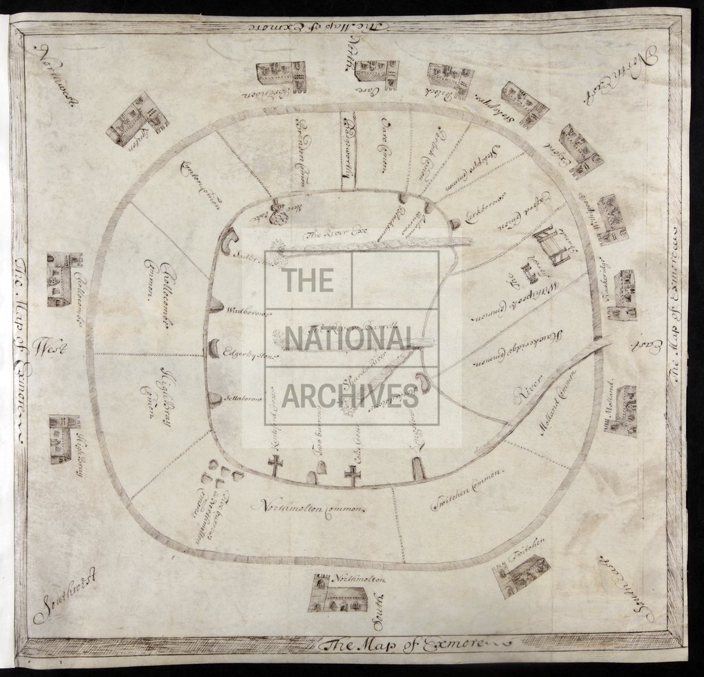
Exmoor showing 'Forest Pounds' on Withipool Common and 'The Hore Oak'
Date:
1673
Reference:
MPB 1/54
Creator:
Maps and plans extracted to flat storage from records of the Exchequer
Catalogue context:
1 item extracted from E 112/389 /269. 'The Map of Exmore' (title in border): diagrammatic map of Exmoor, Devon, showing the extent of the moor with its boundary markers, the commons of the adjacent parishes, rivers, the 'Forest Pounds' on Withipool Common, 'the Hore Oake'. Pictorial representation of parish churches, barrows and marker stones. Cardinal points. To illustrate proceedings of the Exchequer Court in the cause Attorney General v George Arundell.
Categories:
Maps and plans
Subjects:
Archives and libraries; Litigation; Maps and plans; Religions
Topics:
Agriculture and environment; Crime, courts and justice; Land and buildings; Religion
Period:
Early Modern
Copyright information:
Copyright clearance for publication is not required, except in the case of documents in third-party copyright.
Usage terms:
https://www.nationalarchives.gov.uk/documents/information-management/use-of-tna-materials.pdf