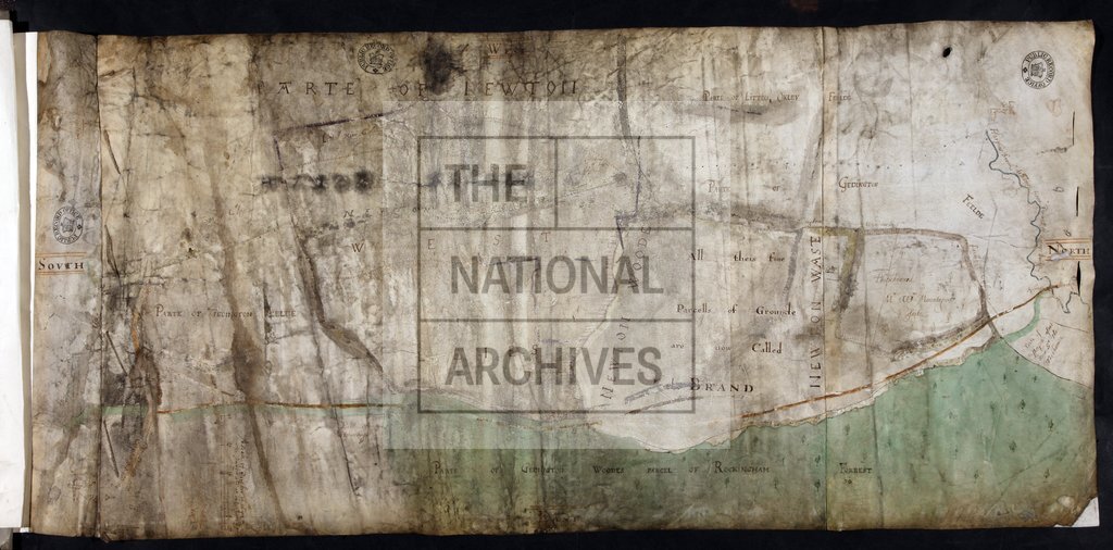
Plan of the Brand by Thomas Henchman and William Randall
Date:
18 September 1610
Reference:
MPBB 1/2 (2)
Creator:
Maps and plans extracted to extra large flat storage from records of the Exchequer
Catalogue context:
2 items extracted from E 178/4318 , mm 22 and 23. Plans of lands in Geddington and Newton, Northamptonshire, in particular of a parcel of land called the Brand, said to form part of the Forest of Rockingham. Buildings shown in perspective. To illustrate dispute between William Montagu and others and Sir Thomas Tresham. Detailed descriptions are given at item level.
Categories:
Maps and plans
Subjects:
Archives and libraries; Maps and plans
Topics:
Land and buildings
Period:
Early Modern
Copyright information:
Copyright clearance for publication is not required, except in the case of documents in third-party copyright.
Usage terms:
https://www.nationalarchives.gov.uk/documents/information-management/use-of-tna-materials.pdf