Part of Braydon Forest, Wiltshire, c1630
Date:
1630
Reference:
MPC 1/51
Creator:
Maps and plans extracted to flat storage from records of the Duchy of Lancaster
Catalogue context:
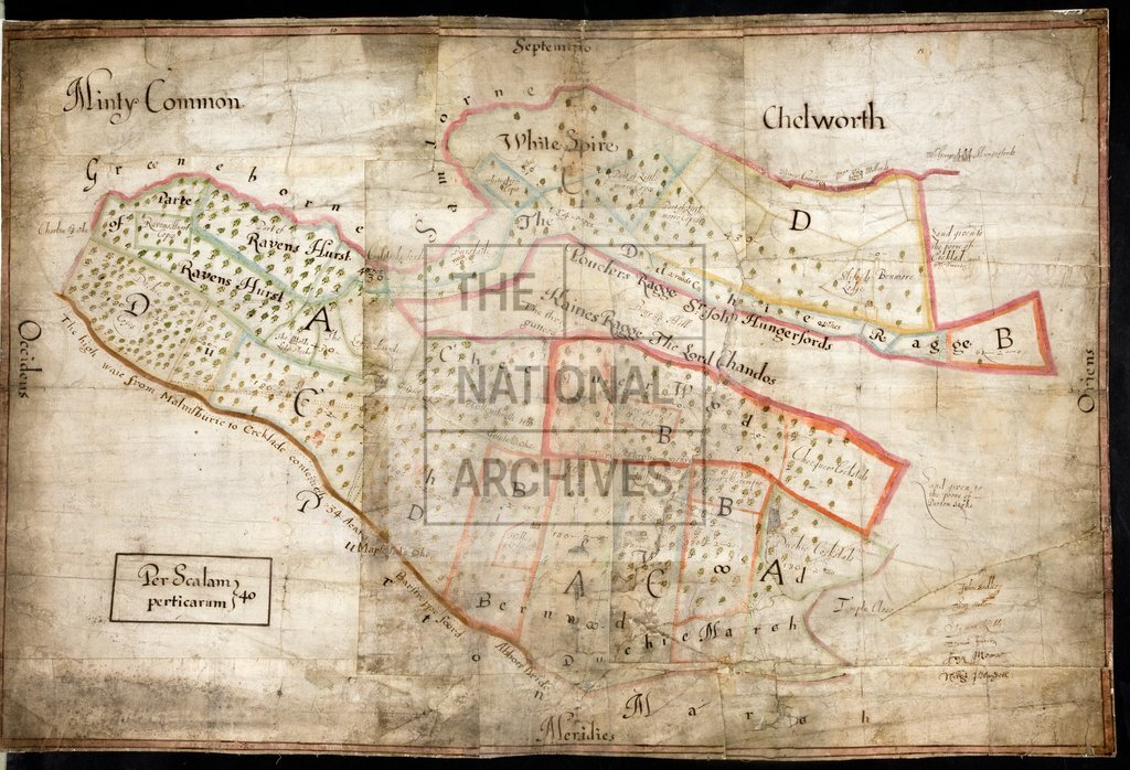
Map of part of Braydon Forest, Wiltshire, showing field names, proprietors, acreage, lodges, a highway, footpaths. Cardinal points. Parcels are lettered; no key. Signatures of commissioners. Apparently made in connection with a proposal to enclose the Forest.
Categories:
Maps and plans
Subjects:
Archives and libraries; Crown lands and estates; Maps and plans
Topics:
Agriculture and environment; Land and buildings
Period:
Early Modern
Copyright information:
Copyright clearance for publication is not required, except in the case of documents in third-party copyright.
Usage terms:
https://www.nationalarchives.gov.uk/documents/information-management/use-of-tna-materials.pdf