Thorne Moor, Goole Moor, land bounded by rivers Aire, Ouse, Humber, Trent, Don and Old Don c1450
Date:
1450
Reference:
MPC 1/56
Creator:
Maps and plans extracted to flat storage from records of the Duchy of Lancaster
Catalogue context:
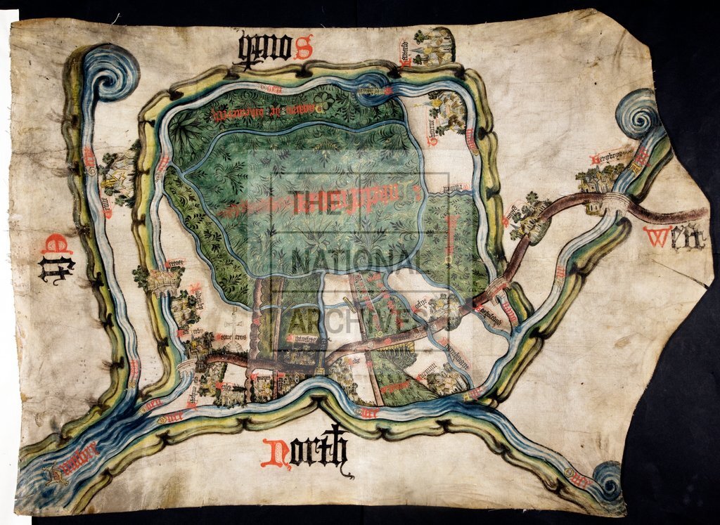
Yorkshire: Thorne Moor and Goole Moor (Inclesmoor). Map of lands bounded by rivers Aire, Ouse, Humber and Trent, Don (Tourne) and old Don (Doen), partly in Lincolnshire; Hatfield and Crowle mark southern edge. Also shows other towns and villages, meres, named pastures, park; roads; trees and plants. Buildings, bridges and crosses in bird's-eye view. Triple division of Airmyn Moor into 'parts of 10,000'. Text in Latin: place-names and cardinal points in English. No scale shown. Oriented to the south. Cardinal points shown. Endorsed: 'No 61 Indorsed thus, Snayth The platt of Water of Eyre'. This covers an older endorsement, now obscured. To illustrate a dispute over turbaries and pasturage in the moor between the Duchy of Lancaster and St Mary's Abbey, York.
Categories:
Maps and plans
Topics:
Land and buildings
Period:
Medieval
Copyright information:
Copyright clearance for publication is not required, except in the case of documents in third-party copyright.
Usage terms:
https://www.nationalarchives.gov.uk/documents/information-management/use-of-tna-materials.pdf