Dedham disputed lands 17th century
Date:
1660-1699
Reference:
MPC 1/70 (3)
Creator:
Maps and plans extracted to flat storage from records of the Duchy of Lancaster
Catalogue context:
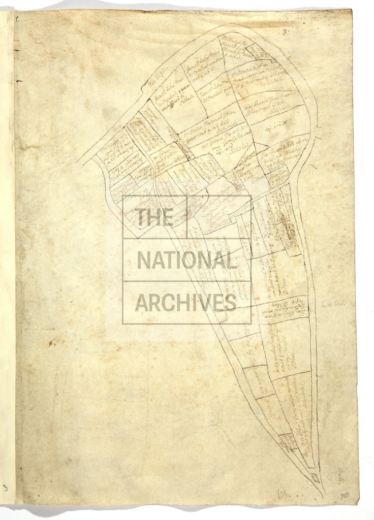
Eight maps (on five sheets) of disputed lands at Dedham, Essex, to show field names, acreage, tenants, and to which manor they belonged; roads, gates, boundaries, Sherburne brook and mill, ponds, trees, heathland. Houses in simple perspective. No scale shown. Cardinal points. Oriented to the east. Sizes between 30 cm x 22 cm and 41 cm x 49.5 cm. Some sheets bear reference to page numbers, presumably of written survey. MPC 1/70 folio 3 bears the date 31 August 1573. These are late seventeenth-century copies of maps at MPC 1/276 , item 3; and maps in MPC 1/77 , items 4, 5, 6r, 7; the latter bear note of examination by Benjamin Ayloffe, (attorney to the Duchy of Lancaster Court, and keeper of Duchy records from 1685). For a commission and depositions in the same case, dated 16 Eliz I, see DL 4/16/18 .
Categories:
Maps and plans
Topics:
Land and buildings
Period:
Early Modern
Copyright information:
Copyright clearance for publication is not required, except in the case of documents in third-party copyright.
Usage terms:
https://www.nationalarchives.gov.uk/documents/information-management/use-of-tna-materials.pdf