The Fens, described by Jonas Moore c1658
Date:
1658
Reference:
MPC 1/88 (1)
Creator:
Maps and plans extracted to flat storage from records of the Duchy of Lancaster
Catalogue context:
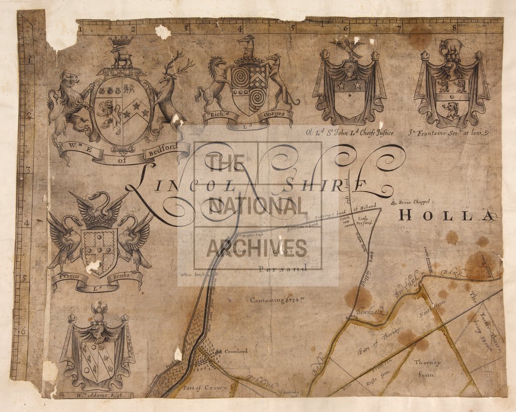
The Fens: 'A Mapp of ye Great Levell of ye Fenns extending into ye Countyes of Northampton, Norfolk, Suffolke, Lyncolne, Cambridge & Huntington & the Isle of Ely as it is now drained, described by. Jonas Moore Surveyr genll'. Shows fens, waterways, dykes, woods, commons, roads, parks (including 'Coll Cromwell's parck' near Ramsey Mere), landowners' names, mills, churches etc; acreage; lots identified by number (no key). Scale: 2 inches to 1 mile; scale runs along borders. Cardinal points in borders. Title in cartouche representing a wall. Arms [?of Fifth Earl of Bedford's Company for Draining the Fens] above title. Arms of gentry, parliamentarians and military officers. Sixteen roughly cut sheets, each mounted on page 60 cm x 49 cm, bound in volume. [John] 'Goddard Sculp'.
Categories:
Maps and plans
Subjects:
Archives and libraries; Crown lands and estates; Forestry; Maps and plans
Topics:
Agriculture and environment; Land and buildings
Period:
Early Modern
Copyright information:
Copyright clearance for publication is not required, except in the case of documents in third-party copyright.
Usage terms:
https://www.nationalarchives.gov.uk/documents/information-management/use-of-tna-materials.pdf