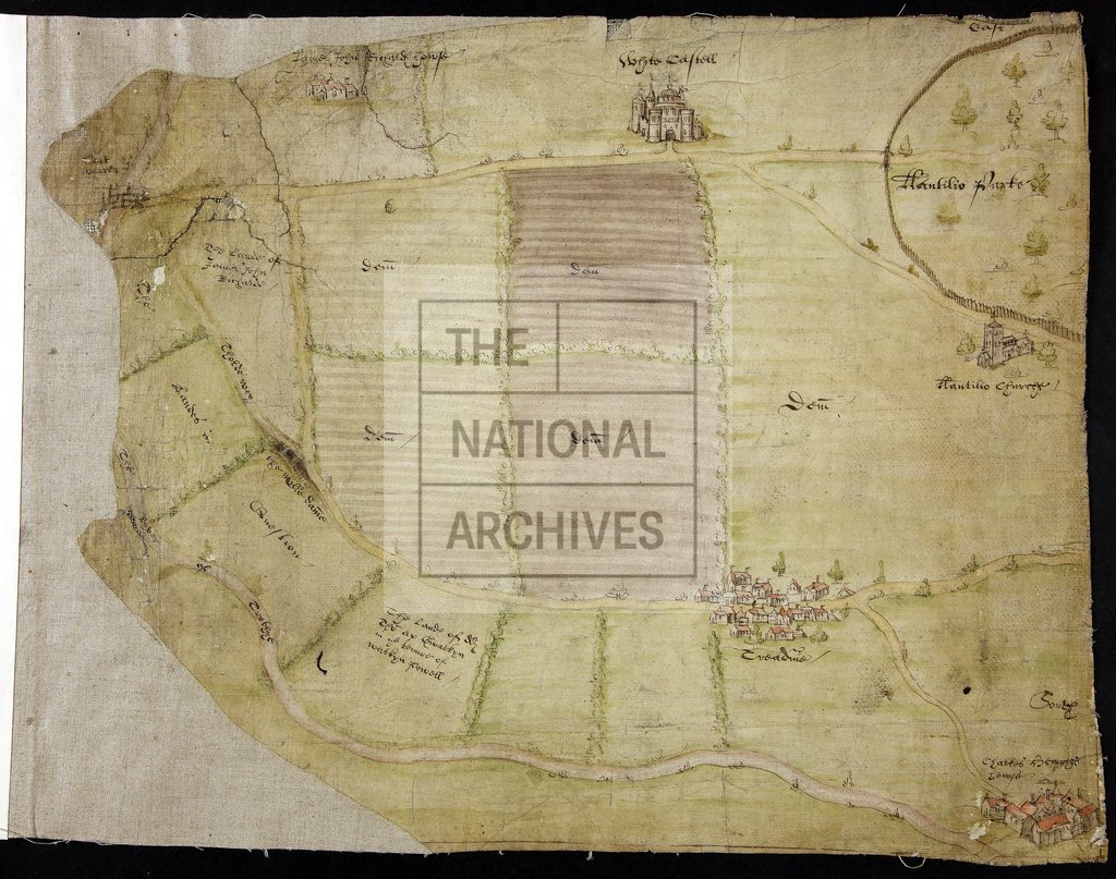
White Castle and environs, Gwent
Date:
1571
Reference:
MPC 1/93
Creator:
Maps and plans extracted to flat storage from records of the Duchy of Lancaster
Catalogue context:
Map showing area around Llantilio Croeseny, Monmouthshire (now Llandeilo Gresynni, Gwent). White Castle, Llantilio church, houses of Charles Hughes and James John Richard and in hamlet of Tre-Adam, all drawn in perspective. Also shows bridge at Pont Warren, Llantilio Park with paling, demesne land, the River Trothy, a mill dam, lands of Hughes and Richards and in tenure of Watkyn Powell, and lands in dispute. No scale shown. East and south shown: oriented to the north-east. Produced in a cause heard in the Court of the Duchy of Lancaster in 1571 concerning title to land, between William, Earl of Worcester, the Queen's lessee, and Charles Hughes.
Categories:
Maps and plans
Subjects:
Archives and libraries; Crown lands and estates; Maps and plans; Religions
Topics:
Religion; Land and buildings
Period:
Early Modern
Copyright information:
Copyright clearance for publication is not required, except in the case of documents in third-party copyright.
Usage terms:
https://www.nationalarchives.gov.uk/documents/information-management/use-of-tna-materials.pdf