Survey of woodlands in Monmouthshire belonging to the Duchy of Lancaster
Date:
1608
Reference:
MPC 1/108 (5)
Creator:
Maps and plans extracted to flat storage from records of the Duchy of Lancaster
Catalogue context:
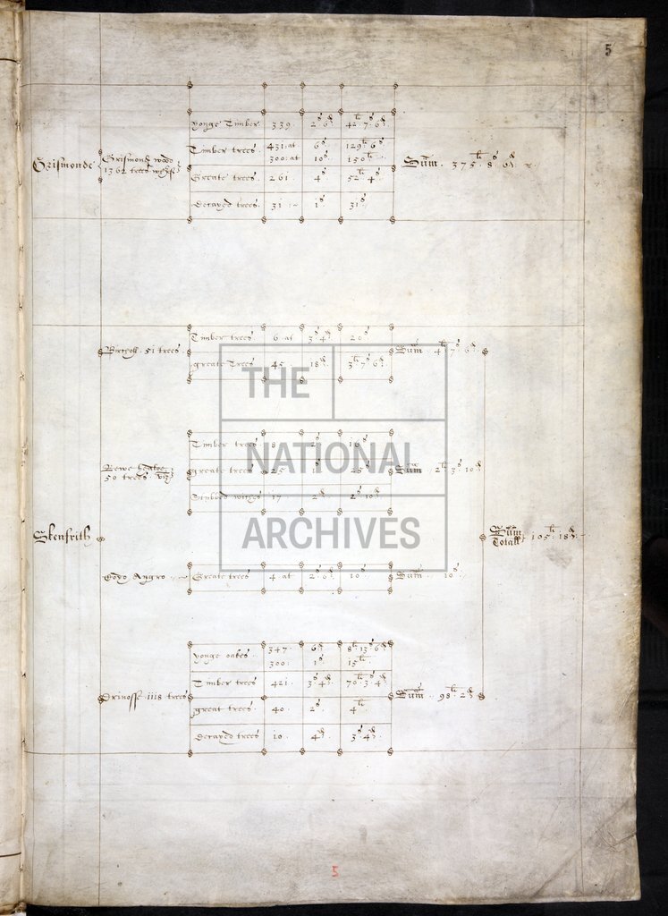
Survey of woodlands in Monmouthshire belonging to the Duchy of Lancaster: Hadnock Wood, Buckhold [Wood], 'Coyde Baghan' in Rockfield and St Maughans, White Castle manor, 'Grismonde' Wood in Grosmont, Skenfrith Woods, 'Earles Wood' in Caldicot. Maps show coppices, proprietors, field-names, acreage, customary lands, common and waste lands, roads. (On folio 6r) scale in fretwork cartouche surmounted by dividers: 1 inch to 40 perches. Compass star. Cardinal points. On pages facing maps are tables showing types, numbers and value of trees in each coppice. The survey was produced is response to a commission to the Earl of Worcester (said to be annexed, but it is not); it is signed (on folio 6 v) by W[illiam] Powell, Matthew Nelson, and C[harles] Somerset, deputies for the Earl.
Categories:
Maps and plans
Subjects:
Archives and libraries; Crown lands and estates; Forestry; Manors; Maps and plans
Topics:
Agriculture and environment; Land and buildings
Period:
Early Modern
Copyright information:
Copyright clearance for publication is not required, except in the case of documents in third-party copyright.
Usage terms:
https://www.nationalarchives.gov.uk/documents/information-management/use-of-tna-materials.pdf