Whitehall Palace
Date:
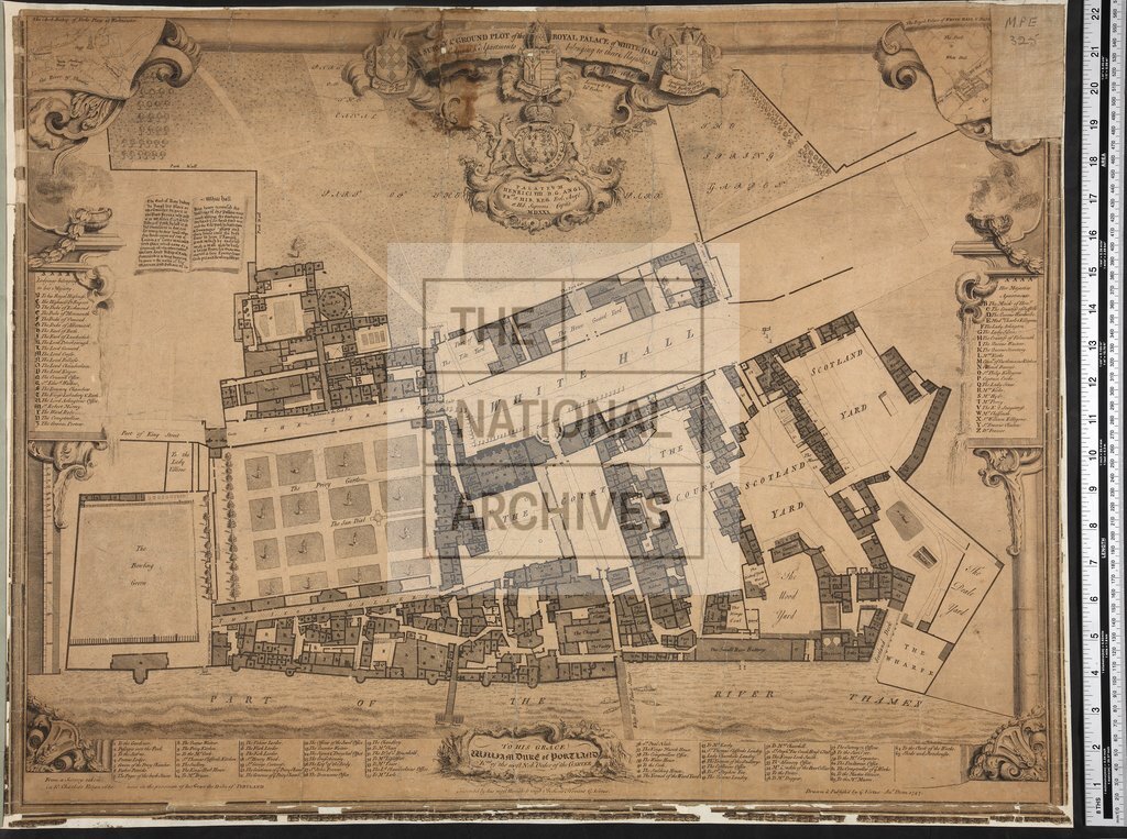
1747
Reference:
MPE 1/325
Creator:
Maps and plans extracted to flat storage from records of the Office of Land Revenue Records and Enrolments
Catalogue context:
Middlesex: Westminster (now in London Borough of Westminster). 'A Survey & Ground Plot of the Royal Palace of White Hall with the Lodgings & Apartments belonging to their Majesties. A o . D. 1680. Survey'd by In o Fisher'. Scale: 1 inch to about 60 feet. With decorative border. Engraved and published by G[eorge] Vertue, 1747.
Categories:
Maps and plans
Subjects:
Archives and libraries; Maps and plans
Topics:
Land and buildings
Period:
Early Modern
Copyright information:
Copyright clearance for publication is not required, except in the case of documents in third-party copyright.
Usage terms:
https://www.nationalarchives.gov.uk/documents/information-management/use-of-tna-materials.pdf