Richmond Palace
Date:
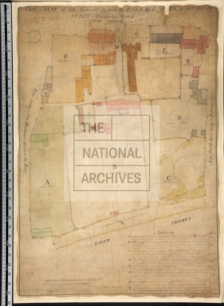
1752
Reference:
MPE 1/362 (2)
Creator:
Maps and plans extracted to flat storage from records of the Office of Land Revenue Records and Enrolments
Catalogue context:
Surrey: Richmond. (1) Plan of site of old palace, showing names of occupiers. Reference table. Scale: 1 inch to about 37 feet. Compass indicator. Surveyed by Charles Evans, 23 March 1756. (2) A copy of (1). Dimensions of sheets: (1) 77.0 cm x 54.9 cm; (2) 80.3 cm x 56.1 cm.
Categories:
Maps and plans
Subjects:
Archives and libraries; Maps and plans
Topics:
Land and buildings
Period:
Empire And Industry
Copyright information:
Copyright clearance for publication is not required, except in the case of documents in third-party copyright.
Usage terms:
https://www.nationalarchives.gov.uk/documents/information-management/use-of-tna-materials.pdf