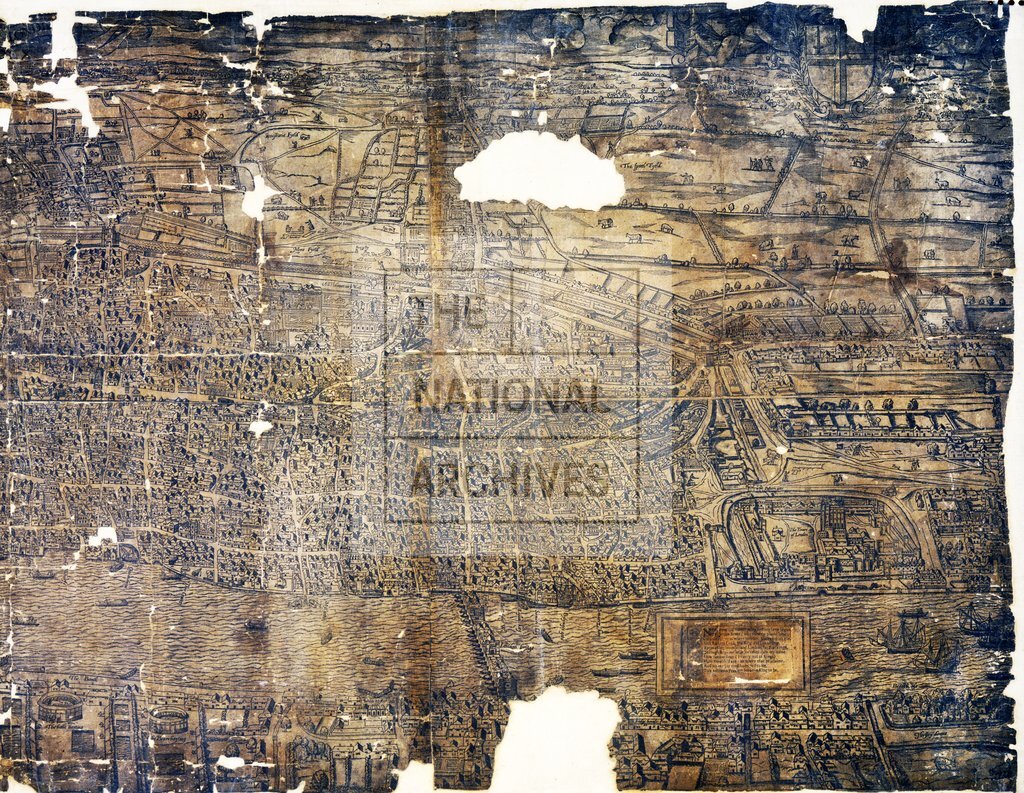
Ralph Agas woodcut of London 1560s right half (c1633 copy)
Date:
1633
Reference:
MPEE 1/25
Creator:
Maps and plans extracted to extra large flat storage from records of the Office of Land Revenue Records and Enrolments
Catalogue context:
London and Middlesex. 'Civitas Londi[nium]'. Panoramic view of London, from St James's Park and Westminster Hall (both now in the London Borough of Westmnister) to Smithfield and the Tower of London, and from just south of the River Thames to the northern hills. Shows streets (some named), fields, waterways, quays, ships and boats, tenter grounds, human figures and animals. Buildings drawn in bird's-eye view: St Paul's Cathedral, churches, gates, crosses, London Bridge, bull and bear baiting rings, windmills. Title on ribbon. Arms of James I at top left; arms of the City of London at top right, supported by two putti. Ornate cartouche at lower left gives history of the city; plain cartouche at lower right contains ten lines of verse. No scale shown. Oriented to the north. Inscribed 'MDLX'. The original woodcut is thought to have been made by Ralph Agas in the early 1560s, after the burning of the spire of St Paul's cathedral in 1561. This is a copy of a later edition, presumed to have been made in 1633, f...
Categories:
Maps and plans
Subjects:
Archives and libraries; Crown lands and estates; Maps and plans; Religions; Royal Parks; Sports
Topics:
Agriculture and environment; Arts and culture; Land and buildings; Religion
Period:
Early Modern
Places:
London
Copyright information:
Copyright clearance for publication is not required, except in the case of documents in third-party copyright.
Usage terms:
https://www.nationalarchives.gov.uk/documents/information-management/use-of-tna-materials.pdf