Sheppey, fortification c1574
Date:
1574
Reference:
MPF 1/9
Creator:
Maps and plans extracted to flat storage from records of the State Paper Office
Catalogue context:
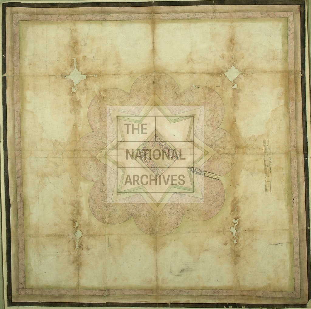
Kent: ?Swaleness marsh, opposite Queensborough on the Isle of Sheppey. Plan of a fortification with eight points surrounded by a moat, with drawbridge shown raised, in bird's-eye view. At centre, a perspective view of houses around a courtyard within the keep; two stairways to walls at centre of opposite sides of keep. Hatched border within black border. Scale bar: 1 inch to 20 feet. Bears no cardinal points or legends. Endorsed in hand of William Cecil: '.. in ye Swale near Q[uen]borough for def[…] of ye Shipps'. Andrews and Colvin suggest that the plan may be by an engineer named Robert Lythe (Lyeth or Lueth), who reported on the defensive situation of Sheppey to the Privy Council in 1574. The plan may illustrate a proposal rather than actual works. It is apparently a finished version of the plan at MPF 1/8 , although the houses in the keep are different in details.
Categories:
Maps and plans
Subjects:
Archives and libraries; Maps and plans
Topics:
Land and buildings
Period:
Early Modern
Copyright information:
Copyright clearance for publication is not required, except in the case of documents in third-party copyright.
Usage terms:
https://www.nationalarchives.gov.uk/documents/information-management/use-of-tna-materials.pdf