Armagh, Ireland c1609
Date:
1609
Reference:
MPF 1/63
Creator:
Maps and plans extracted to flat storage from records of the State Paper Office
Catalogue context:
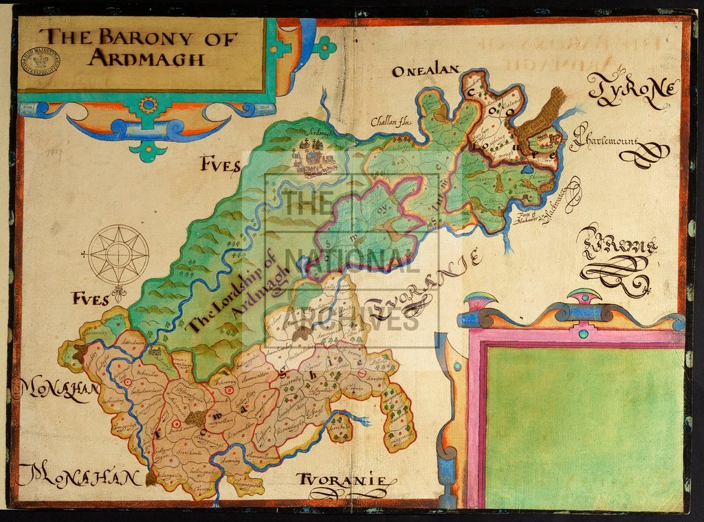
County Armagh. Map of 'The Barony of Ardmagh', showing bog and woodland, and churches, houses and hills in perspective. Names of properties given. Fretwork cartouches top left, containing title, and lower right, empty. Black and red border. No scale shown. Compass star.right, empty. Black and red border. No scale shown. Compass star. 1 item extracted from SP 64/2 (item 29). To view papers accompanying this map, visit http://www.nationalarchives.gov.uk/records/irish-maps-state-papers.htm.
Categories:
Maps and plans; Overseas
Subjects:
Archives and libraries; Forestry; Ireland; Maps and plans; Religions
Topics:
Agriculture and environment; International trade and affairs; Land and buildings; Religion
Period:
Early Modern
Places:
Ireland
Copyright information:
Copyright clearance for publication is not required, except in the case of documents in third-party copyright.
Usage terms:
https://www.nationalarchives.gov.uk/documents/information-management/use-of-tna-materials.pdf