Idrone, Ireland c1580
Date:
1580
Reference:
MPF 1/70
Creator:
Maps and plans extracted to flat storage from records of the State Paper Office
Catalogue context:
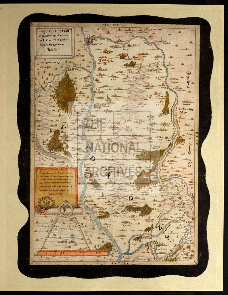
County Carlow: Idrone Barony. 'The description of the Baronye of Udrone in the County of Catherlagh in the Realme of Irelande'; map showing hills in relief, rivers, and woodlands. Places named and indicated by drawings of churches and other buildings. Scale: about 5 inches to 4 miles. Cardinal points in border. Endorsed with notes on Irish manors and their owners. by drawings of churches and other buildings. Scale: about 5 inches to 4 miles. Cardinal points in border. Endorsed with notes on Irish manors and their owners. 1 item extracted from SP 64/1 (item 3). To view papers accompanying this map, visit http://www.nationalarchives.gov.uk/records/irish-maps-state-papers.htm.
Categories:
Maps and plans; Overseas
Subjects:
Archives and libraries; Forestry; Ireland; Manors; Maps and plans; Religions
Topics:
Agriculture and environment; International trade and affairs; Land and buildings; Religion
Period:
Early Modern
Places:
Ireland
Copyright information:
Copyright clearance for publication is not required, except in the case of documents in third-party copyright.
Usage terms:
https://www.nationalarchives.gov.uk/documents/information-management/use-of-tna-materials.pdf