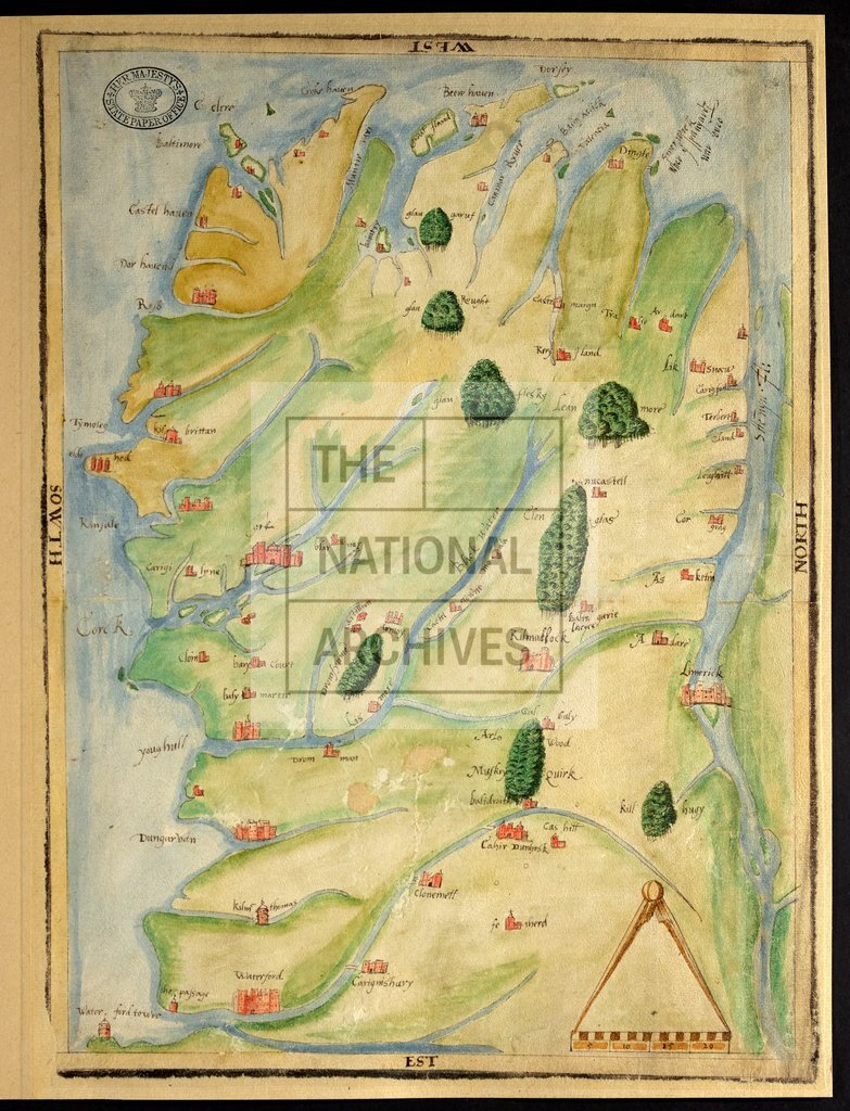
Munster, Ireland c1580
Date:
1580
Reference:
MPF 1/74
Creator:
Maps and plans extracted to flat storage from records of the State Paper Office
Catalogue context:
Munster (except County Clare). Map showing place-names, rivers, forests, and towns indicated by buildings in elevation. Scale bar surmounted by dividers: 1 inch to 13 Irish miles. Cardinal points in border. Additions showing Somerwick in hand of Lord Burghley. Additions showing Somerwick in hand of Lord Burghley. 1 item extracted from SP 64/1 (item 7). To view papers accompanying this map, visit http://www.nationalarchives.gov.uk/records/irish-maps-state-papers.htm.
Categories:
Maps and plans; Overseas
Subjects:
Archives and libraries; Forestry; Ireland; Maps and plans
Topics:
Agriculture and environment; International trade and affairs; Land and buildings
Period:
Early Modern
Places:
Ireland
Copyright information:
Copyright clearance for publication is not required, except in the case of documents in third-party copyright.
Usage terms:
https://www.nationalarchives.gov.uk/documents/information-management/use-of-tna-materials.pdf