Smerwick Harbour, County Kerry, Ireland early 17th century
Date:
1580
Reference:
MPF 1/75
Creator:
Maps and plans extracted to flat storage from records of the State Paper Office
Catalogue context:
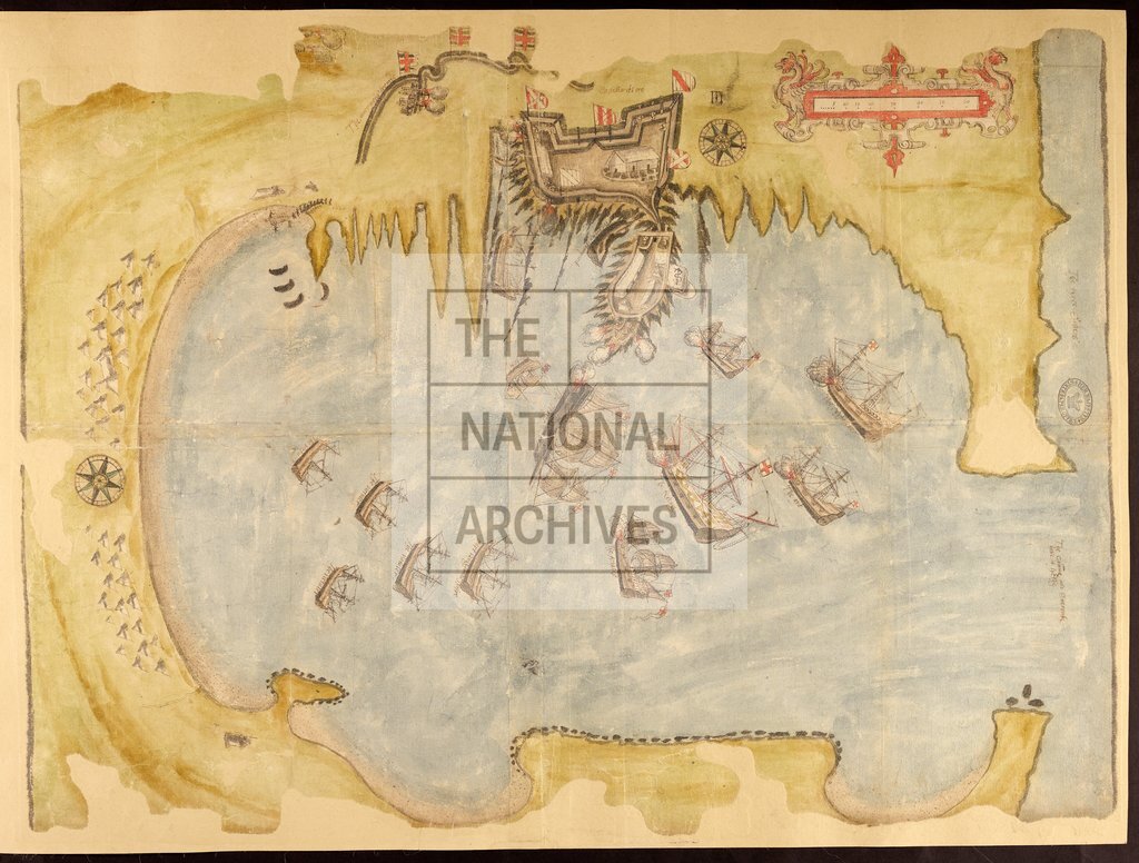
County Kerry. Plan of Smerwick Harbour, showing the siege of the Castello del Oro. English ships shown and named. Also shows guns, figures, buildings and tents of attacking force. Scale bar in fretwork cartouche with heraldic beasts: 1 inch to 15 [?perches]. Compass indicators. [Drawn by William Winter].ouche with heraldic beasts: 1 inch to 15 [?perches]. Compass indicators. [Drawn by William Winter]. 1 item extracted from SP 64/1 (item 8). To view papers accompanying this map, visit http://www.nationalarchives.gov.uk/records/irish-maps-state-papers.htm.
Categories:
Maps and plans; Overseas
Subjects:
Archives and libraries; Ireland; Maps and plans; Weapons
Topics:
International trade and affairs; Land and buildings; Military and war
Period:
Early Modern
Places:
Ireland
Copyright information:
Copyright clearance for publication is not required, except in the case of documents in third-party copyright.
Usage terms:
https://www.nationalarchives.gov.uk/documents/information-management/use-of-tna-materials.pdf