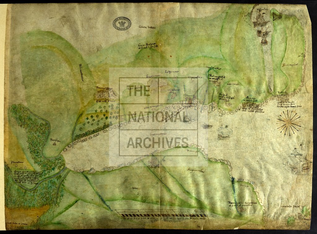
Belfast Lough, Ireland c1579
Date:
1569
Reference:
MPF 1/77
Creator:
Maps and plans extracted to flat storage from records of the State Paper Office
Catalogue context:
Map of Belfast Lough, showing Belfast, Carrickfergus, Larne Lough, and Island Magee (County Antrim): Copeland Island and Bangor, County Down. Also shows woods, ships, and buildings in perspective. Scale: 1 inch to 1 mile. Compass star. [Drawn by Robert Lythe]. Annotated by Sir William Cecil. inch to 1 mile. Compass star. [Drawn by Robert Lythe]. Annotated by Sir William Cecil. 1 item extracted from SP 64/1 (item 10). To view papers accompanying this map, visit http://www.nationalarchives.gov.uk/records/irish-maps-state-papers.htm.
Categories:
Maps and plans; Overseas
Subjects:
Archives and libraries; Forestry; Ireland; Maps and plans
Topics:
Agriculture and environment; International trade and affairs; Land and buildings
Period:
Early Modern
Places:
Ireland
Copyright information:
Copyright clearance for publication is not required, except in the case of documents in third-party copyright.
Usage terms:
https://www.nationalarchives.gov.uk/documents/information-management/use-of-tna-materials.pdf