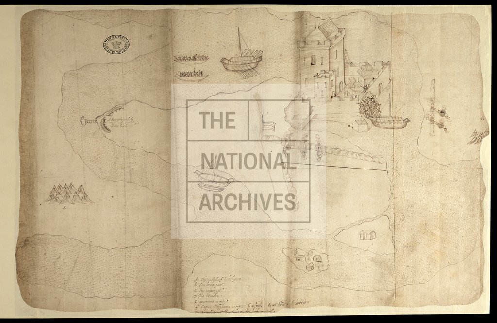
Castle of Enniskillen, Ireland
Date:
1594
Reference:
MPF 1/80
Creator:
Maps and plans extracted to flat storage from records of the State Paper Office
Catalogue context:
County Fermanagh: Enniskillen. 'Plat of the fort of Eniskillin, showing Captain Bingham's camp'. Perspective view of Eniskillen fort, showing camp, boats on river, cannon firing at fort, English assault through breach. Reference table. Endorsed February 1593[-4].rough breach. Reference table. Endorsed February 1593[-4]. 1 item extracted from SP 64/1 (item 13). To view papers accompanying this map, visit http://www.nationalarchives.gov.uk/records/irish-maps-state-papers.htm.
Categories:
Maps and plans; Overseas
Subjects:
Archives and libraries; Canals and river transport; Ireland; Maps and plans; Weapons
Topics:
International trade and affairs; Land and buildings; Military and war; Transport and travel
Period:
Early Modern
Places:
Ireland
Copyright information:
Copyright clearance for publication is not required, except in the case of documents in third-party copyright.
Usage terms:
https://www.nationalarchives.gov.uk/documents/information-management/use-of-tna-materials.pdf