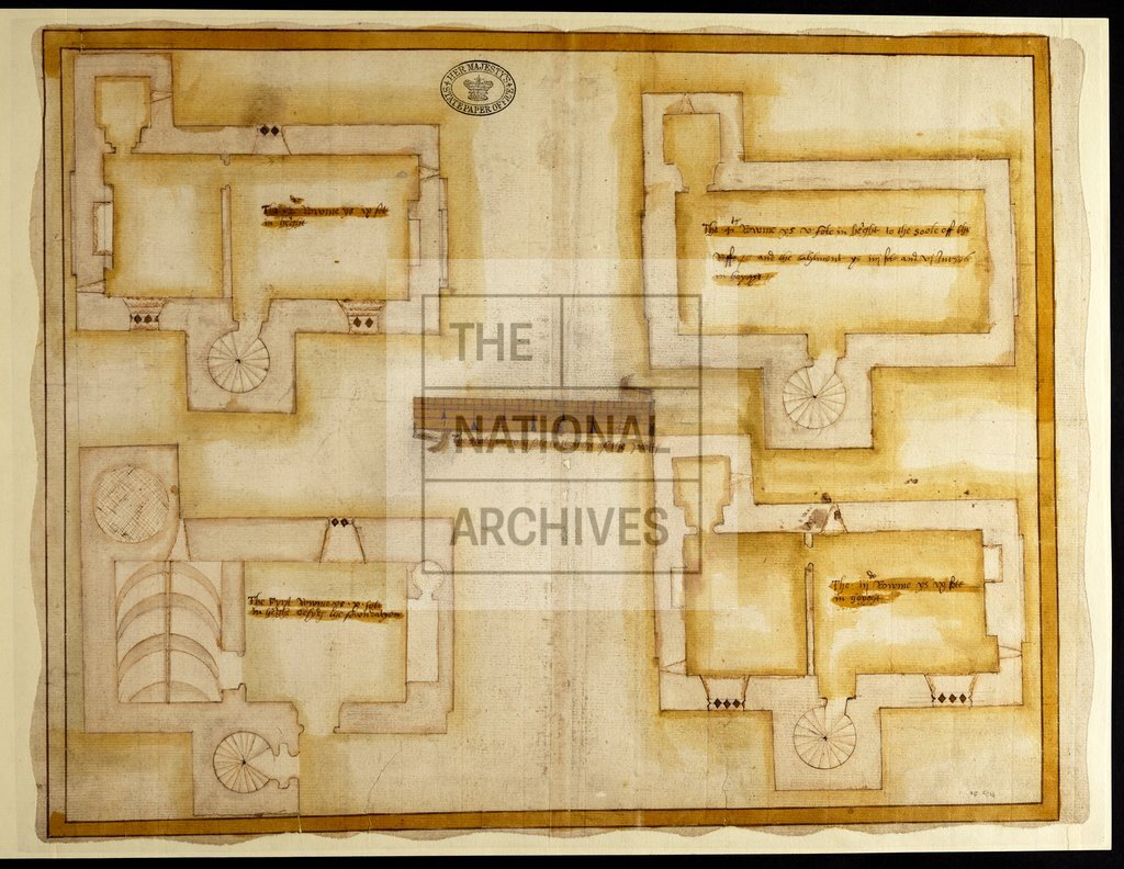
Bagenal's Castle, Newry, Ireland c1570
Date:
1568
Reference:
MPF 1/84
Creator:
Maps and plans extracted to flat storage from records of the State Paper Office
Catalogue context:
County Down: Newry. Plan of the castle, showing rooms and their heights. Scale: 1 inch to 8 feet. 1 item extracted from SP 64/1 (item 17). To view papers accompanying this map, visit http://www.nationalarchives.gov.uk/records/irish-maps-state-papers.htm.
Categories:
Maps and plans; Overseas
Subjects:
Archives and libraries; Ireland; Maps and plans
Topics:
International trade and affairs; Land and buildings
Period:
Early Modern
Places:
Ireland
Copyright information:
Copyright clearance for publication is not required, except in the case of documents in third-party copyright.
Usage terms:
https://www.nationalarchives.gov.uk/documents/information-management/use-of-tna-materials.pdf