County Down, Ireland c1570
Date:
1580
Reference:
MPF 1/88
Creator:
Maps and plans extracted to flat storage from records of the State Paper Office
Catalogue context:
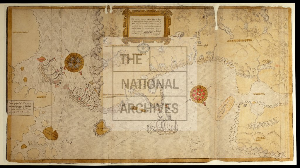
Map of the coast of County Antrim, Ireland, showing churches and other buildings in perspective, sandhills, rabbits, deer, fox, fish, sailing ships, and native Irish people. Fretwork cartouche, containing a note by the author (unknown). Black and yellow border. No scale shown. Two compass roses. the author (unknown). Black and yellow border. No scale shown. Two compass roses. 1 item extracted from SP 64/1 (item 21). To view papers accompanying this map, visit http://www.nationalarchives.gov.uk/records/irish-maps-state-papers.htm.
Categories:
Maps and plans; Overseas
Subjects:
Archives and libraries; Fishing; Ireland; Maps and plans; Religions
Topics:
Agriculture and environment; International trade and affairs; Land and buildings; Religion
Period:
Early Modern
Places:
Ireland
Copyright information:
Copyright clearance for publication is not required, except in the case of documents in third-party copyright.
Usage terms:
https://www.nationalarchives.gov.uk/documents/information-management/use-of-tna-materials.pdf