Bantry Bay, Ireland c1558
Date:
1558
Reference:
MPF 1/94
Creator:
Maps and plans extracted to flat storage from records of the State Paper Office
Catalogue context:
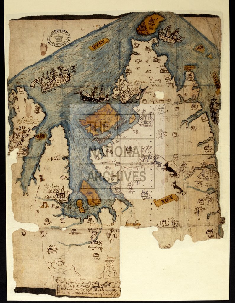
Map of area in County Cork and County Kerry, Ireland, around Bantry Bay. Shows Kenmare River, Dunmannus Bay, and Bantry abbey, forts, houses, and huts, in perspective. Also shows armed men, cannon, trees, deer, wolves, a dog, sailing ships and galleys. No scale shown. Cardinal points at borders. Annotated by Sir William Cecil.ves, a dog, sailing ships and galleys. No scale shown. Cardinal points at borders. Annotated by Sir William Cecil. 1 item extracted from SP 64/1 (item 27). To view papers accompanying this map, visit http://www.nationalarchives.gov.uk/records/irish-maps-state-papers.htm.
Categories:
Maps and plans; Overseas
Subjects:
Archives and libraries; Forestry; Ireland; Maps and plans
Topics:
Agriculture and environment; International trade and affairs; Land and buildings
Period:
Early Modern
Places:
Ireland
Copyright information:
Copyright clearance for publication is not required, except in the case of documents in third-party copyright.
Usage terms:
https://www.nationalarchives.gov.uk/documents/information-management/use-of-tna-materials.pdf