Ireland, Limerick
Date:
1587
Reference:
MPF 1/96
Creator:
Maps and plans extracted to flat storage from records of the State Paper Office
Catalogue context:
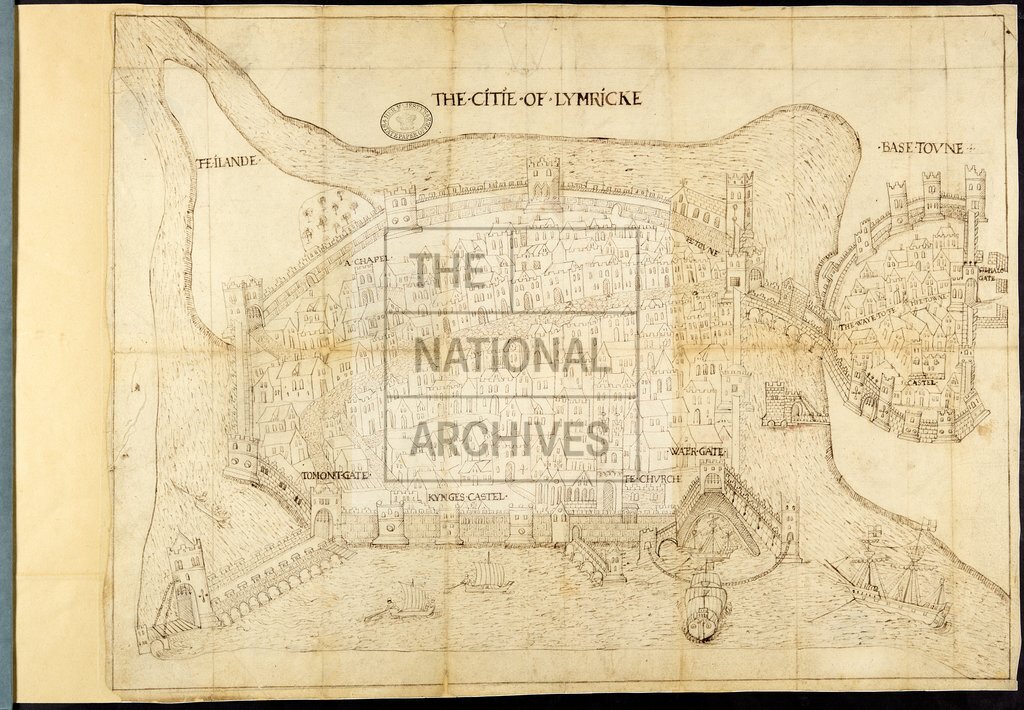
County Limerick: Limerick. 'The Plotte of the Citie of Limbrick': perspective view of the city and base town, showing King's castle, church, chapel, gates, drawbridge and bridge, ramparts, moat; and the harbour with drawings of sailing vessels. [?Drawn by Francis Jobson]. No scale shown.rbour with drawings of sailing vessels. [?Drawn by Francis Jobson]. No scale shown. 1 item extracted from SP 64/1 (item 29). To view papers accompanying this map, visit http://www.nationalarchives.gov.uk/records/irish-maps-state-papers.htm.
Categories:
Maps and plans; Overseas
Subjects:
Archives and libraries; Ireland; Maps and plans; Religions
Topics:
International trade and affairs; Land and buildings; Religion
Period:
Early Modern
Places:
Ireland
Copyright information:
Copyright clearance for publication is not required, except in the case of documents in third-party copyright.
Usage terms:
https://www.nationalarchives.gov.uk/documents/information-management/use-of-tna-materials.pdf