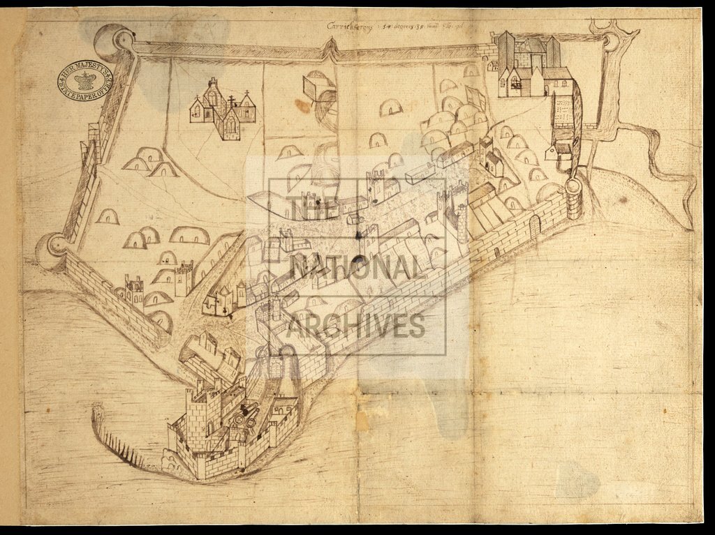
Carrickfergus, Ireland c1600
Date:
1533-1603
Reference:
MPF 1/98
Creator:
Maps and plans extracted to flat storage from records of the State Paper Office
Catalogue context:
County Antrim: Carrickfergus. 'The Plat of Knokefergus': perspective view of the town and castle, showing town walls, cannon, churches, houses and beehive cabins. No scale shown. 1 item extracted from SP 64/1 (item 31). To view papers accompanying this map, visit http://www.nationalarchives.gov.uk/records/irish-maps-state-papers.htm.
Categories:
Maps and plans; Overseas
Subjects:
Archives and libraries; Ireland; Maps and plans; Religions
Topics:
International trade and affairs; Land and buildings; Religion
Period:
Early Modern
Places:
Ireland
Copyright information:
Copyright clearance for publication is not required, except in the case of documents in third-party copyright.
Usage terms:
https://www.nationalarchives.gov.uk/documents/information-management/use-of-tna-materials.pdf