Cork and Kerry, Ireland
Date:
1587
Reference:
MPF 1/100
Creator:
Maps and plans extracted to flat storage from records of the State Paper Office
Catalogue context:
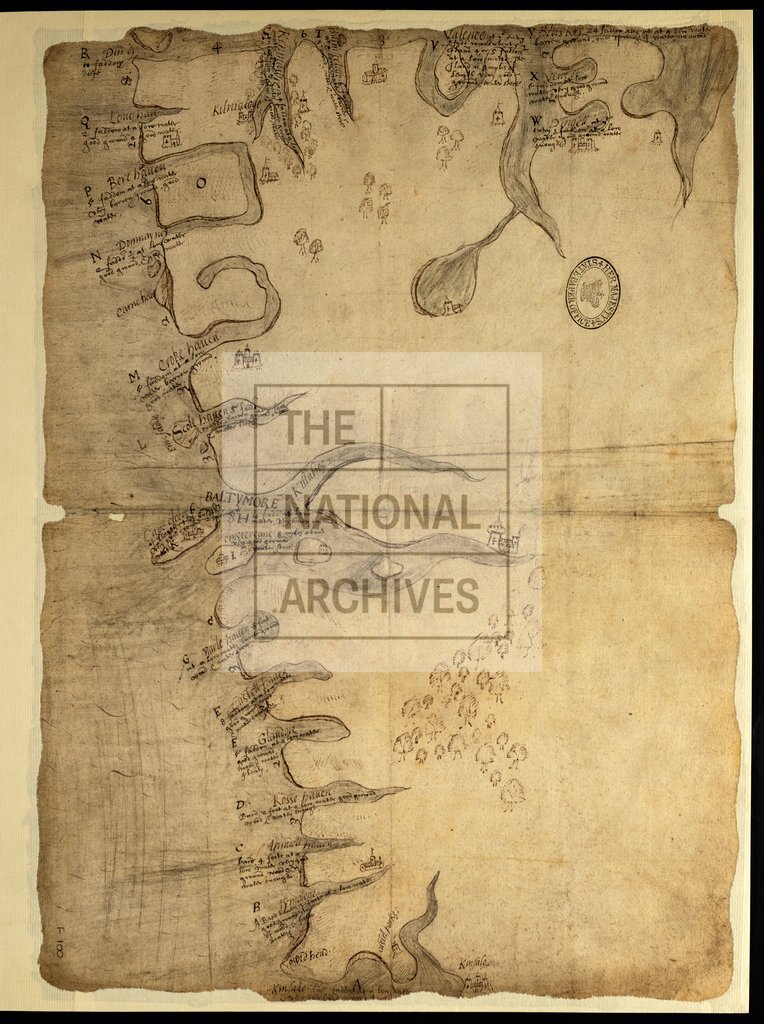
Map of the coast of Munster from Kinsale (County Cork) and Dingle (County Kerry), showing rivers and havens, soundings at low water, holding ground, details of wood and water; castles, churches and other buildings, in rough perspective. The havens are lettered, but no key is given. No scale shown. Buildings, in rough perspective. The havens are lettered, but no key is given. No scale shown. 1 item extracted from SP 64/1 (item 33). To view papers accompanying this map, visit http://www.nationalarchives.gov.uk/records/irish-maps-state-papers.htm.
Categories:
Maps and plans; Overseas
Subjects:
Archives and libraries; Forestry; Ireland; Maps and plans; Religions
Topics:
Agriculture and environment; International trade and affairs; Land and buildings; Religion
Period:
Early Modern
Places:
Ireland
Copyright information:
Copyright clearance for publication is not required, except in the case of documents in third-party copyright.
Usage terms:
https://www.nationalarchives.gov.uk/documents/information-management/use-of-tna-materials.pdf