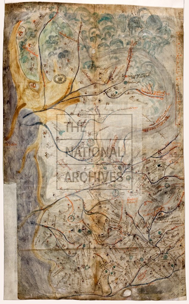
Lancashire, with chief towns, c1590
Date:
1590
Reference:
MPF 1/123
Creator:
Maps and plans extracted to flat storage from records of the State Paper Office
Catalogue context:
1 item extracted from SP 12/235 (item 5). Map of the county of Lancashire, with chief towns named and indicated by a church; castles and some houses drawn in elevation; rivers, sea; and hills roughly indicated. No scale shown.
Categories:
Maps and plans
Subjects:
Archives and libraries; Maps and plans; Religions
Topics:
Religion; Land and buildings
Period:
Early Modern
Copyright information:
Copyright clearance for publication is not required, except in the case of documents in third-party copyright.
Usage terms:
https://www.nationalarchives.gov.uk/documents/information-management/use-of-tna-materials.pdf